Southern Charmers – Part 1

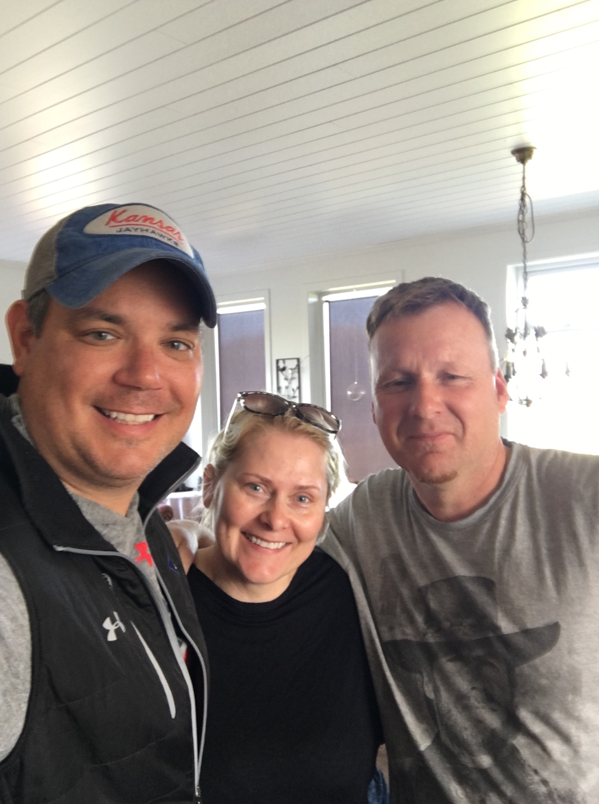
“I’d love to go to Charleston, I’ve always wanted to go!” my cousin Nicole texted as I told her I was booking my flight for Memorial Day Weekend. My other cousins and I had ventured down to Cozumel in January during Martin Luther King Jr week and Nicole had to work and couldn’t make the trip, so this sounded like a great replacement. Something about Charleston always pulls you back, from the perfectly warm weather, the beaches, history and Victorian houses, seafood, nightlife, money and on and on and on. Personally, for me, that is where my favorite author of all-time, Pat Conroy, described in his book “The Lords of Discipline” for which I credit as my favorite book of all-time and the inspiration for what made me decide to be an English major with the creative writing track.

Pat’s description of Charleston stemmed from him being a student-athlete playing basketball at The Citadel. I had a calling to get there 12 years ago to walk the campus (even though it’s moved to a new campus since the time he was attending the school). I took a picture next to the huge junior class ring that stands like a monument adjacent to the large grass quad. Every young male in Charleston is expected to attend The Citadel and represent the state and the country in this military school that forms discipline and honor. Pat was ex-communicated for a very long time after his book came out as the school didn’t think they were portrayed in a true light, but Pat was never one to back away from truth in his novels as his English teacher in high school always told him that the best author’s hold nothing back, as that creates truly great storytelling, you must NEVER hold anything back. This would haunt Pat for many years with his family and portray them in a truthful, but not elegant light and they resented him for it. But, this is all another story, however anxious to return with my cousin that had been the birthplace of my inspiration, but for her, it was her first time and I could see it anew through her eyes.

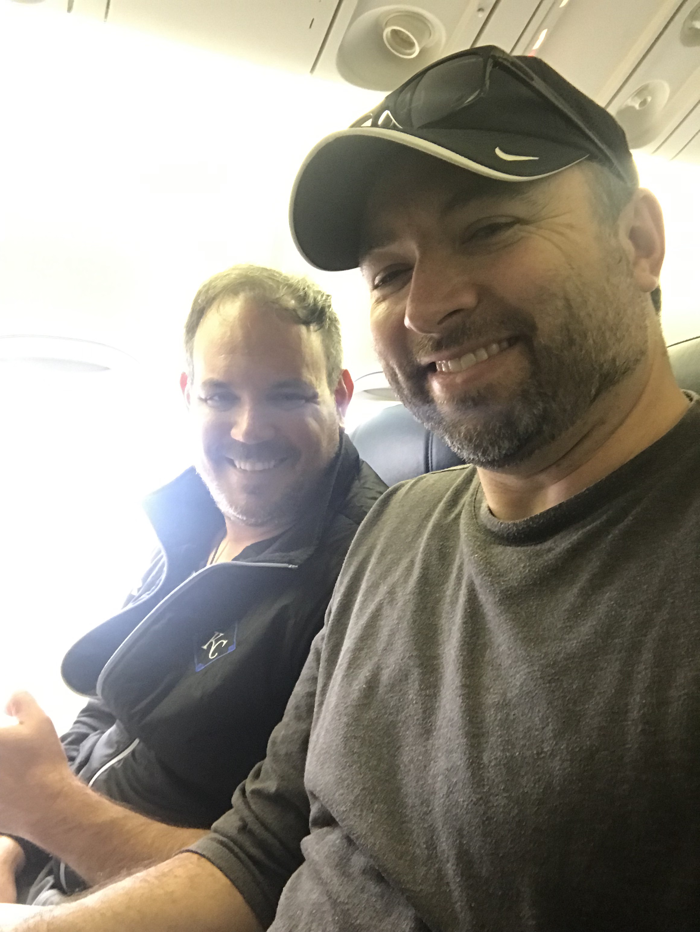
The morning of May 22 arrived and we were on our way. We made a quick layover in Chicago Midway and then boarded the Southwest flight to Charleston. The original plan was to stay in a hotel downtown in Historic Charleston at the Hyatt Home Hotel and be able to walk to all the bars from the Bravo TV reality show Southern Charm. We both had been watching the show for seven years and were anxious to hit all the nightlife spots and possibly hang with some of the cast while out and about.

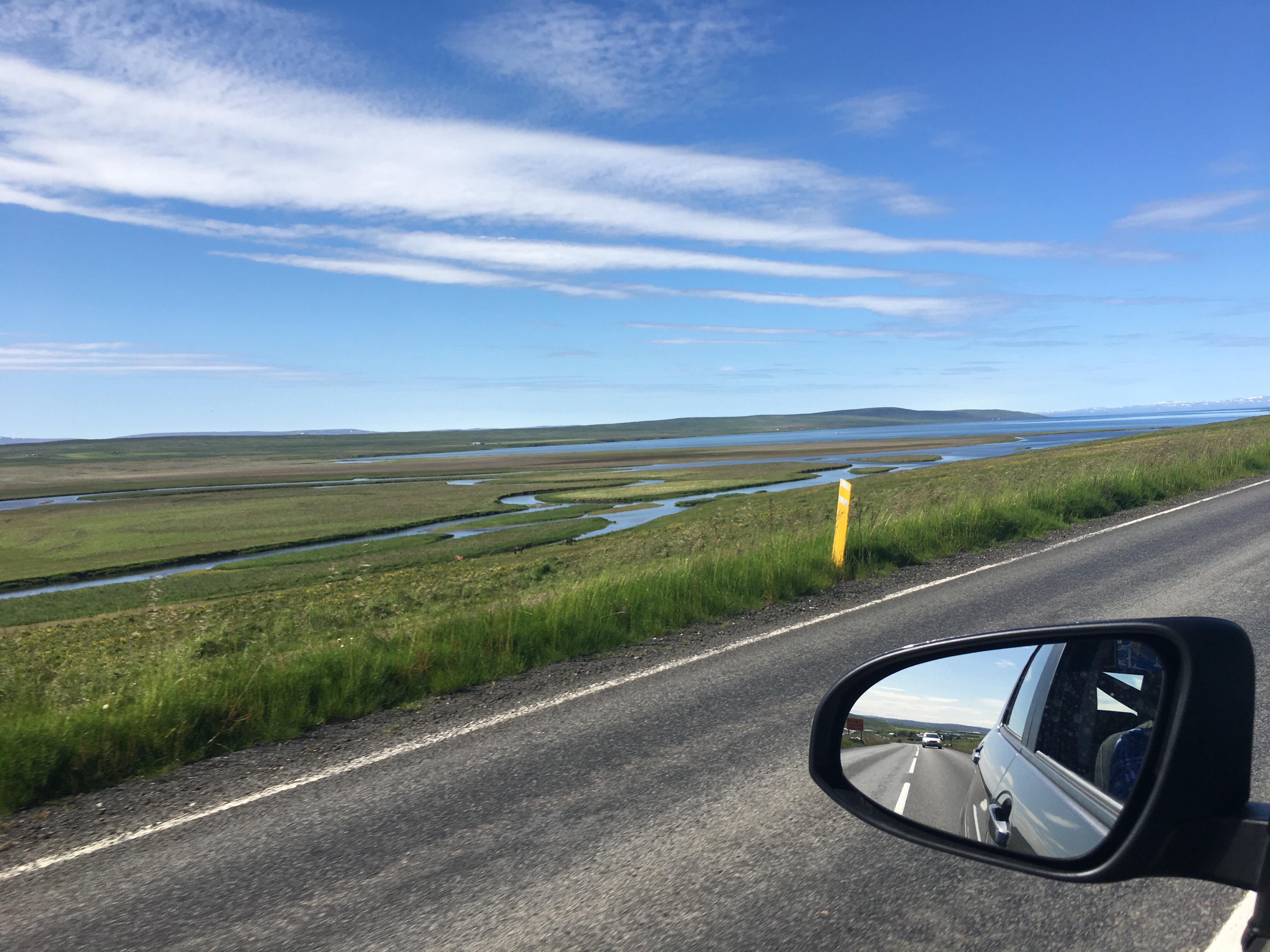
After we landed and got an Uber to the Hyatt House Hotel in Downtown Charleston, the front desk attendant started laughing when I gave him my reservation info. He said I was booked across town in Mt Pleasant at the Hyatt House Hotel there. I had reserved the hotel through my new Amex Platinum card and wanted to try using the perks on this trip. Well, 0-1 on this one. I called Amex and they reminded me that I had paid an un-refundable reservation in advance and they would have to call the Mt Pleasant hotel to see if they would refund the money. I waited for her to call and cancel the reservation, however, when I then tried to reserve at the hotel they were at, they were 100% booked solid. So, now I was without the reservation in Mt Pleasant at the Hyatt there and there were not reservations at the Hyatt House Hotel I was standing at. While the Amex customer service rep was getting frustrated with me, rightfully so, I asked if she could call and rebook the reservation in Mt Pleasant since all the hotels downtown were twice the cost. She was able to get them to keep my reservation since it hadn’t changed in their system yet and we called an Uber and off we were 15 minutes to the east in the Johnson County version of the Charleston metro, Mt Pleasant.

Our Uber driver on the way was an interesting fella. Ready to move from the USA due to high-rising costs and his plan was to save money to leave to Thailand. He had never been there and didn’t know much about it, other than he thought it was cheaper. I told him to look at Belize since it’s closer in case he needed to get him for anything, such as healthcare, and a lot of American retirees are retiring there and they take the American dollar as currency and English is the official language. He asked if that was a city or a country. So, our geography wizard Uber driver typed the name into his phone will be doing some research on the country I visited last year and received my SCUBA certification and had the time of my life. I think he’ll do ok down there. One life changed in less than a day.

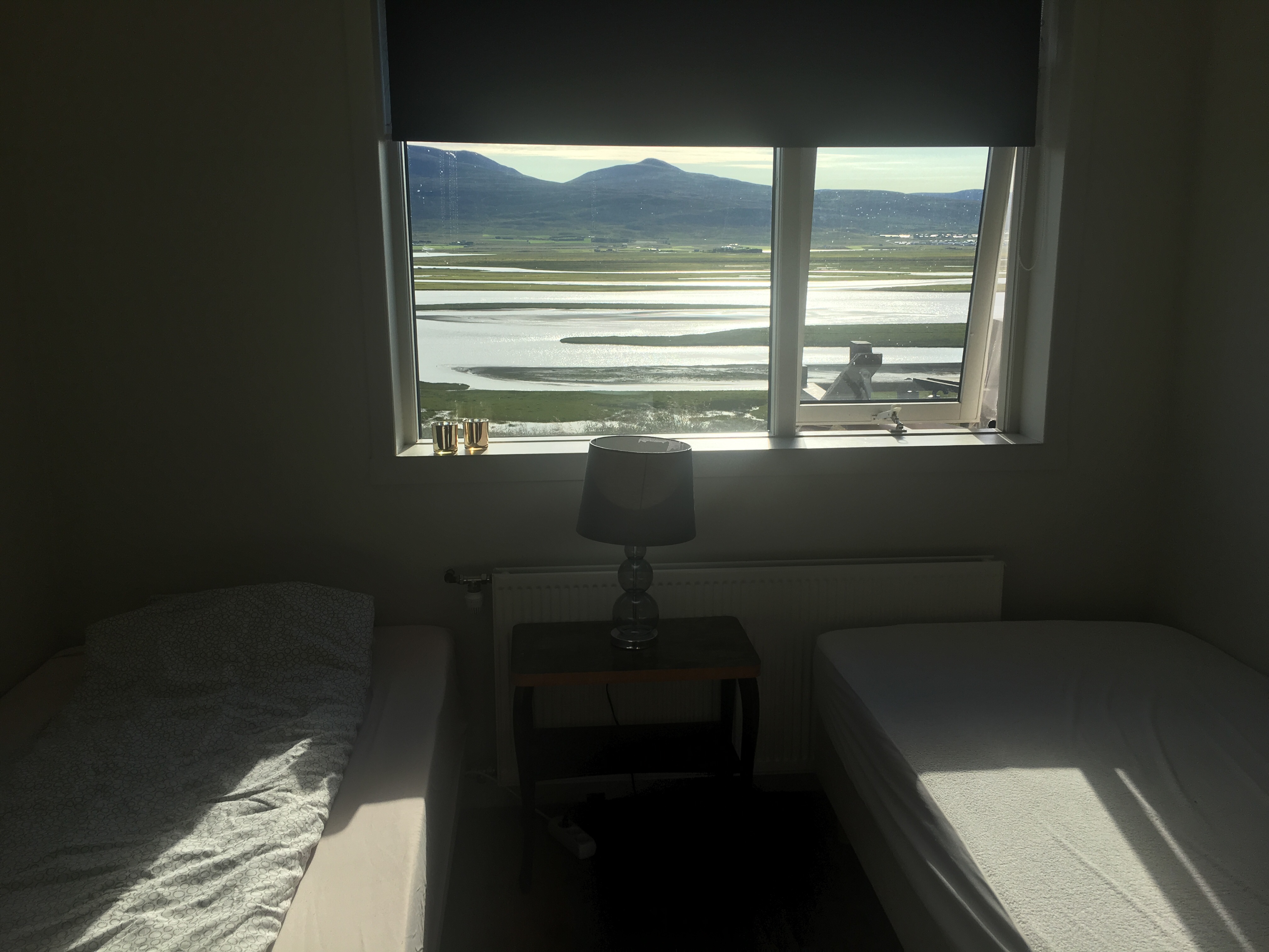
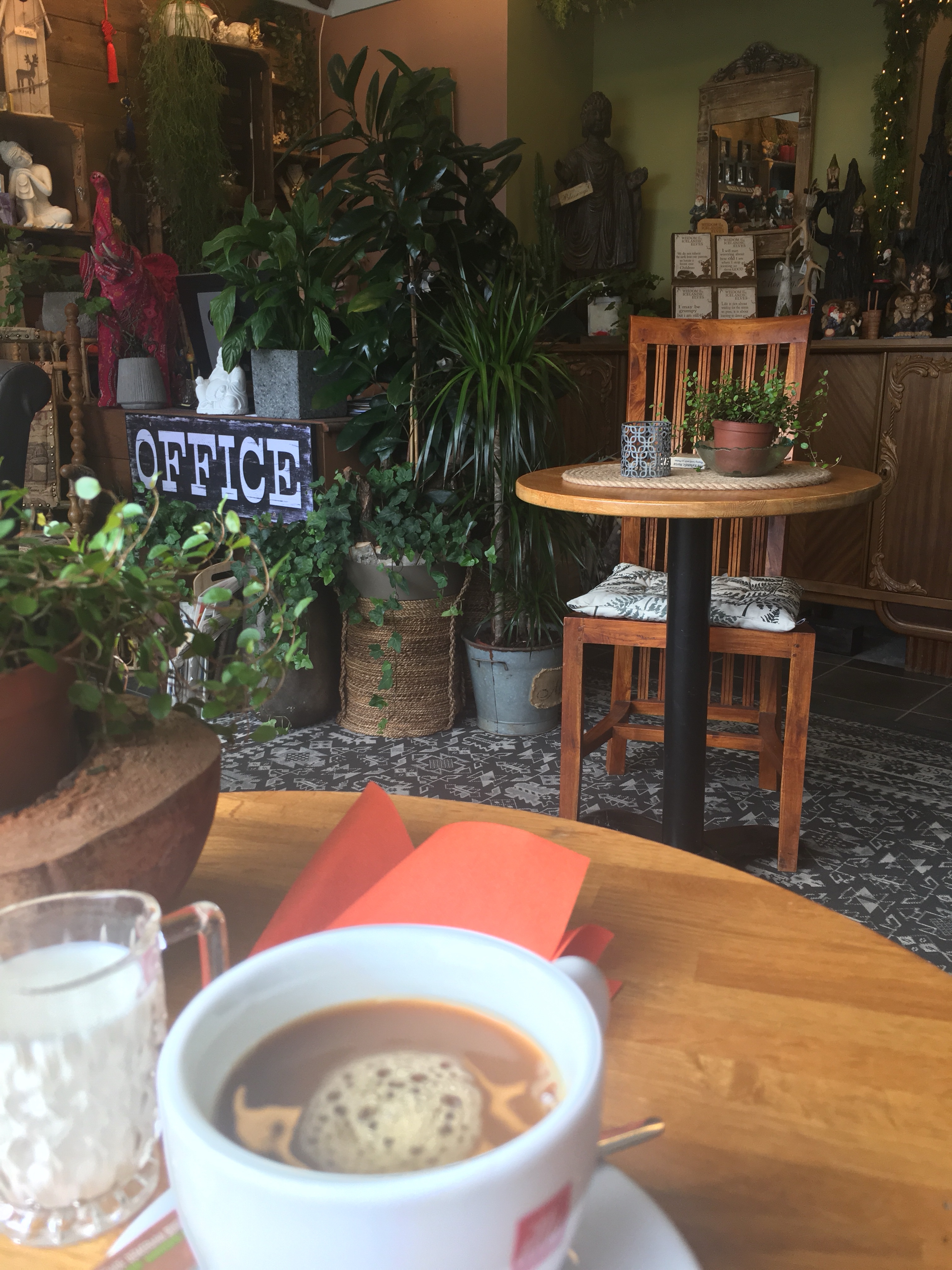
After checking in to our new Hyatt Home Hotel, we were away from most everything but closer to a couple beaches, both Sullivan’s Island Beach and Isle of Palms. Our Uber driver said we should probably hit a beach on Thursday before the weekend and then do any downtown activities on Friday while people were at the beach. Most Charleston folks and visitors head to Folly Beach, that is the party beach with more bars and restaurants, but much more crowded and harder to get Uber’s on the way home since it’s so congested. We planned on hitting Isle of Palms the next morning. In the meantime, we were ready to eat our arms off of our bodies since we were on planes all day and no real food. We had to Uber everywhere since not much was in walking distance of our hotel. You’re welcome, Nicole.

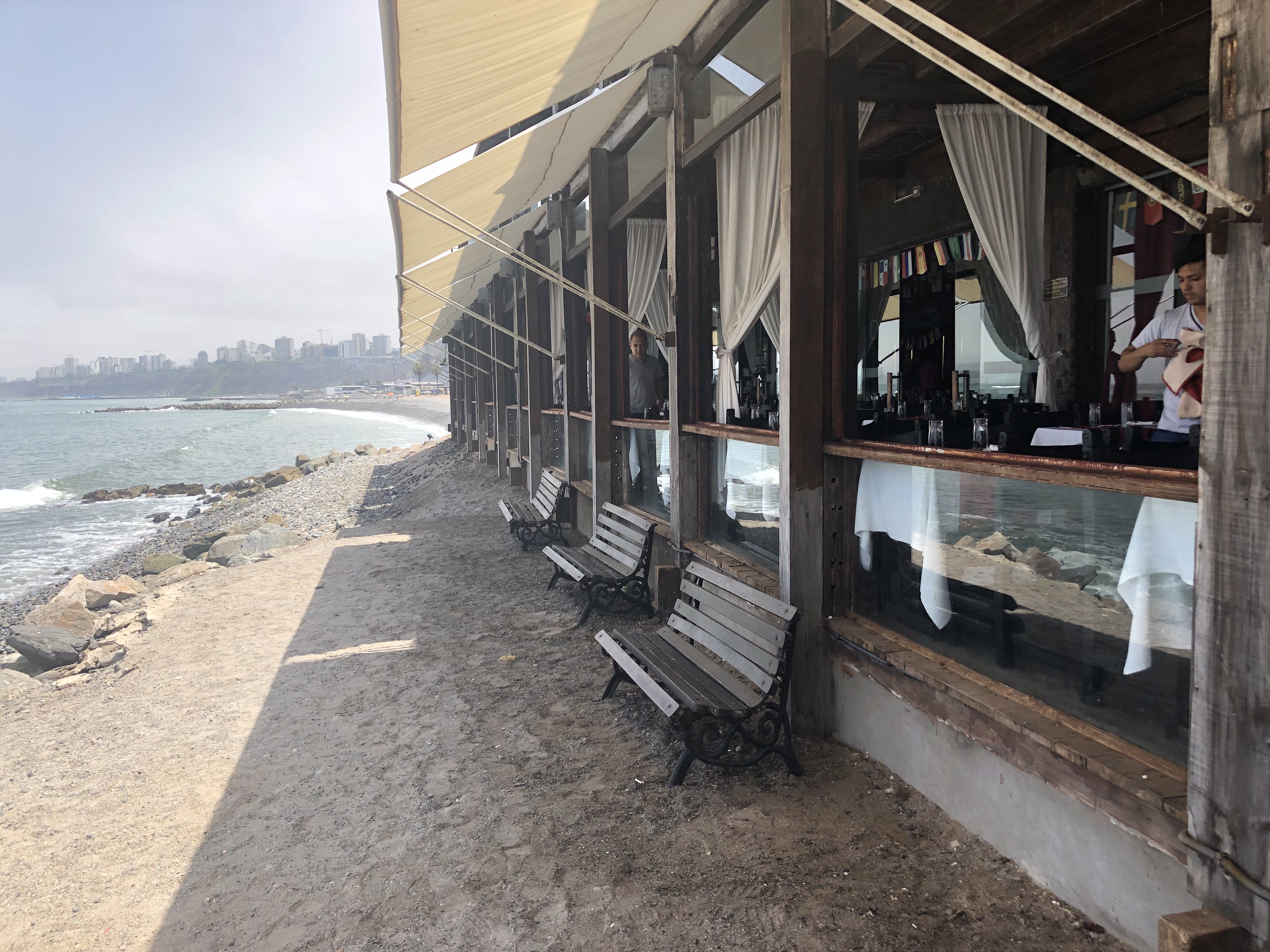
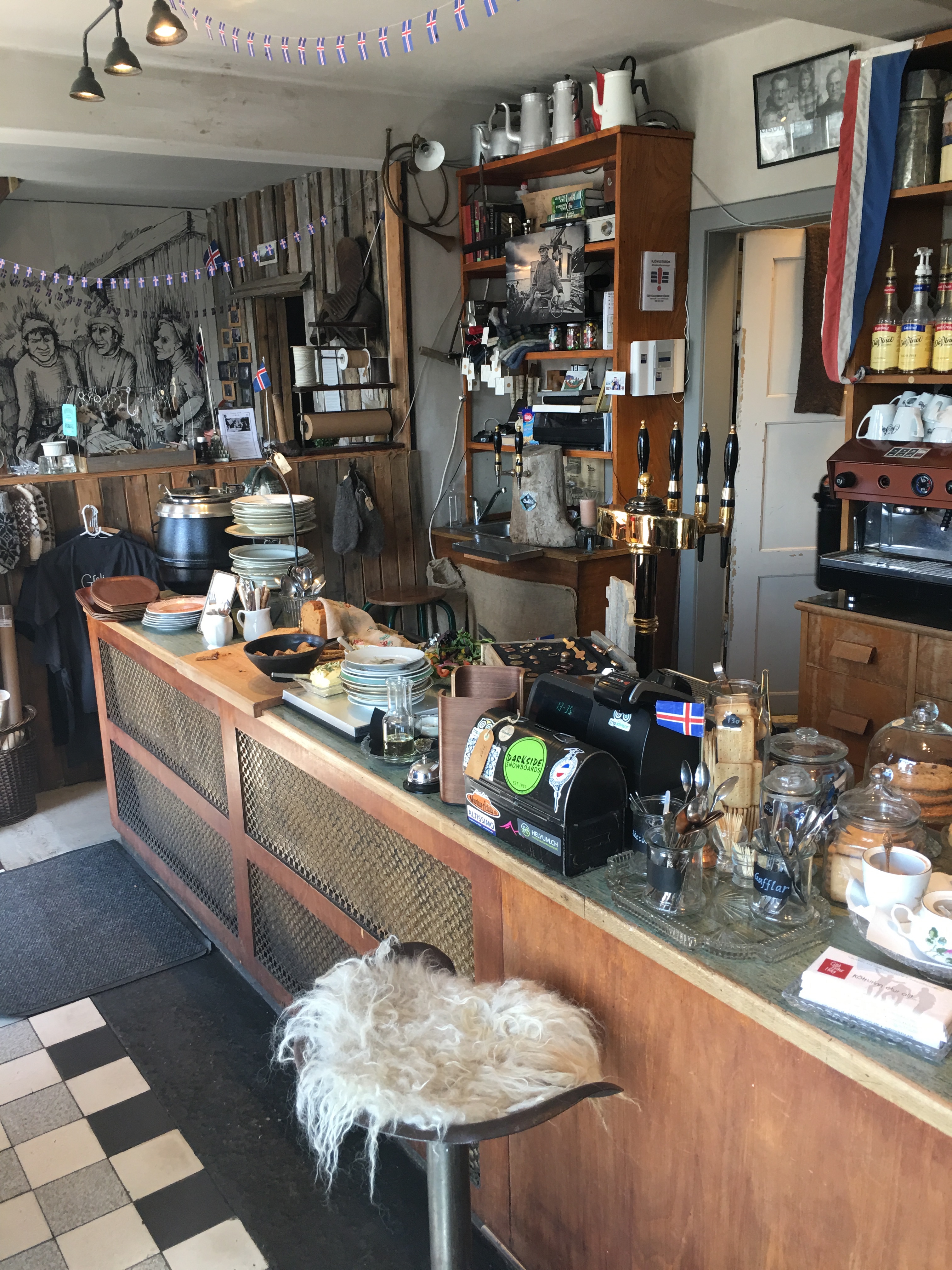
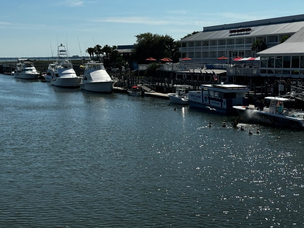
The first stop was to Shem Creek. This creek was the location of many scenes from the Netflix TV series Outer Banks that I was really excited to see. I love that series and needed to see this. There are many bars and restaurants that line up and down this creek and yachts and small boats dock at the bars with marshes all around. They have such restaurants as Water’s Edge (that has a really nice hotel right next to it), and then on the other side is Tavern and Table, Red’s Iced House and Saltwater Cowboy. We were dropped off at Water’s Edge, but the outdoor patio didn’t open until 4p and it was 3p.

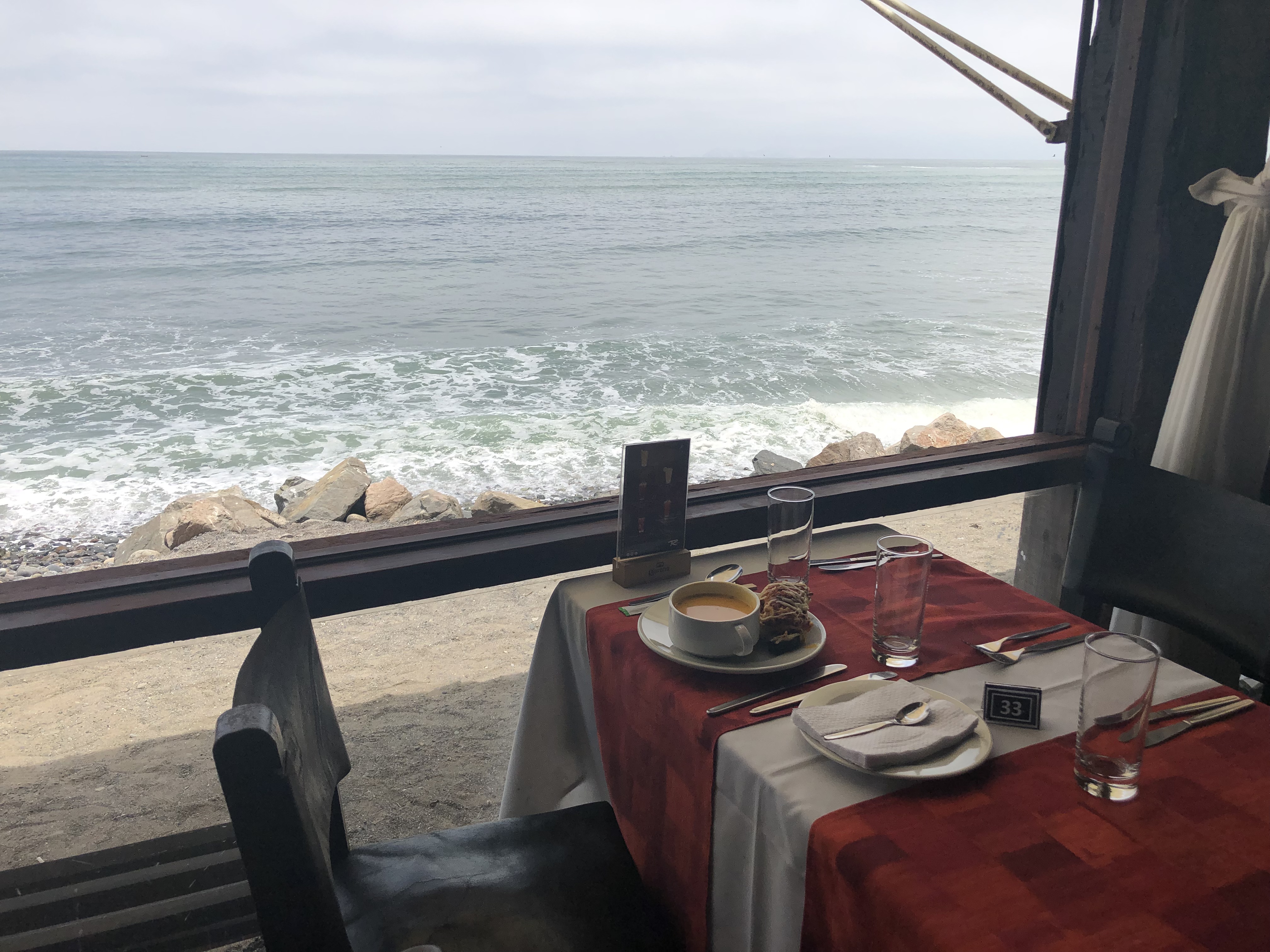
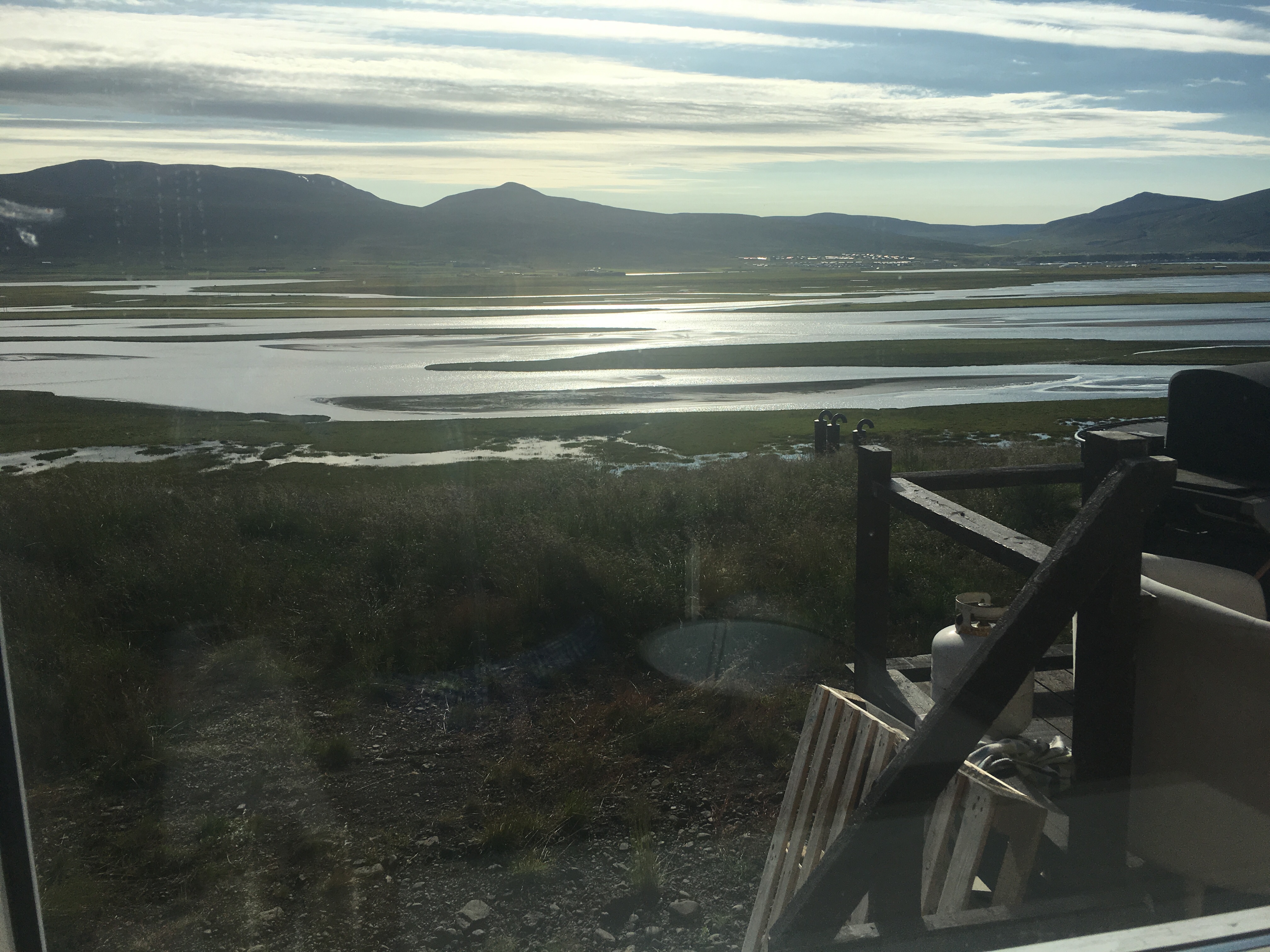
Water’s Edge is to the right in this pic

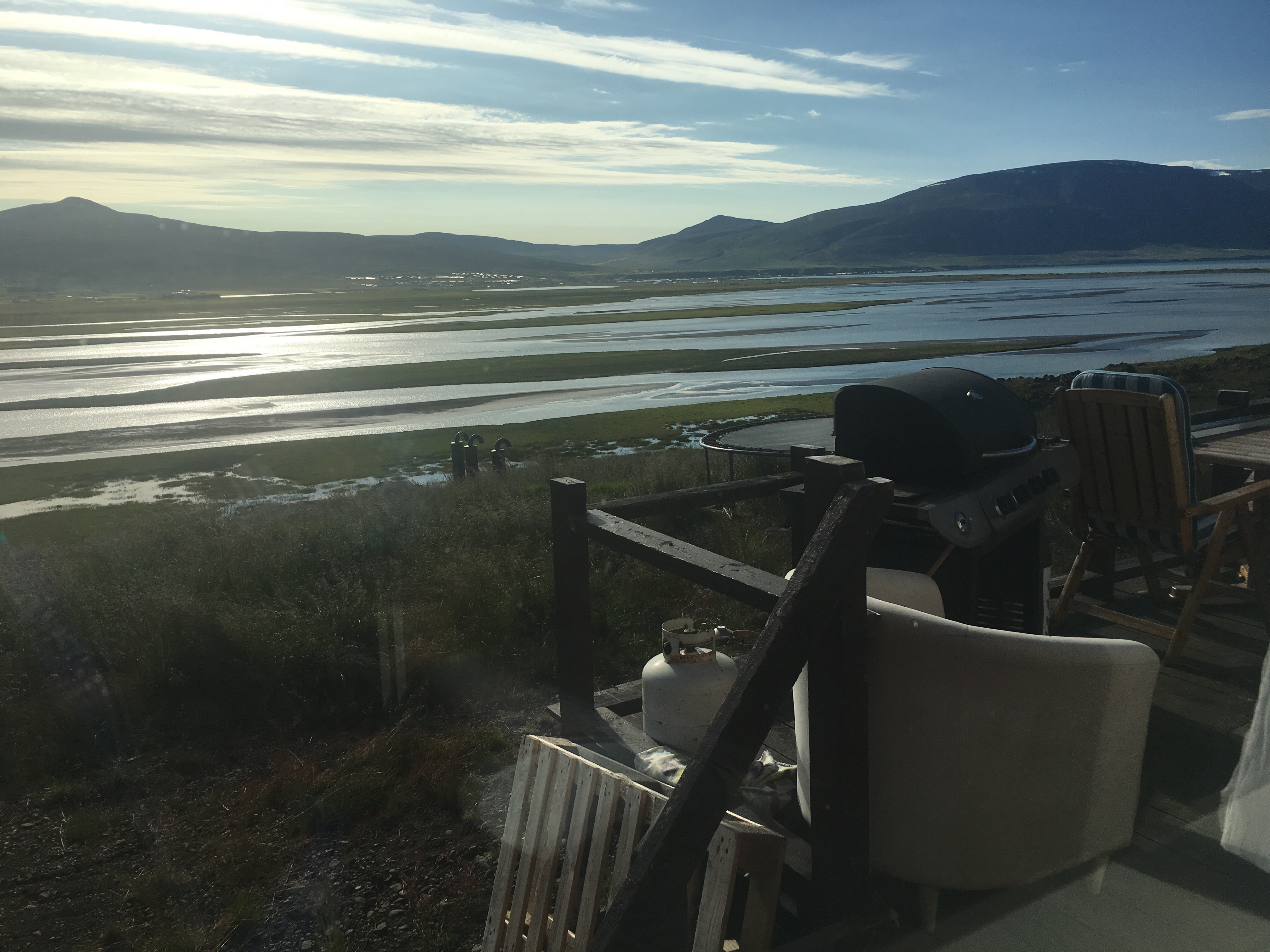
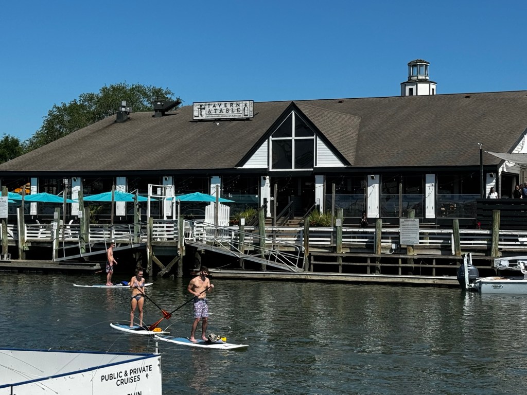
So we walked the bridge across to Tavern and Table and agreed to order some apps until 4p when Water’s Edge patio opened for dinner. Tavern and Table in pic below with standup paddleboarding folks on Shem Creek.

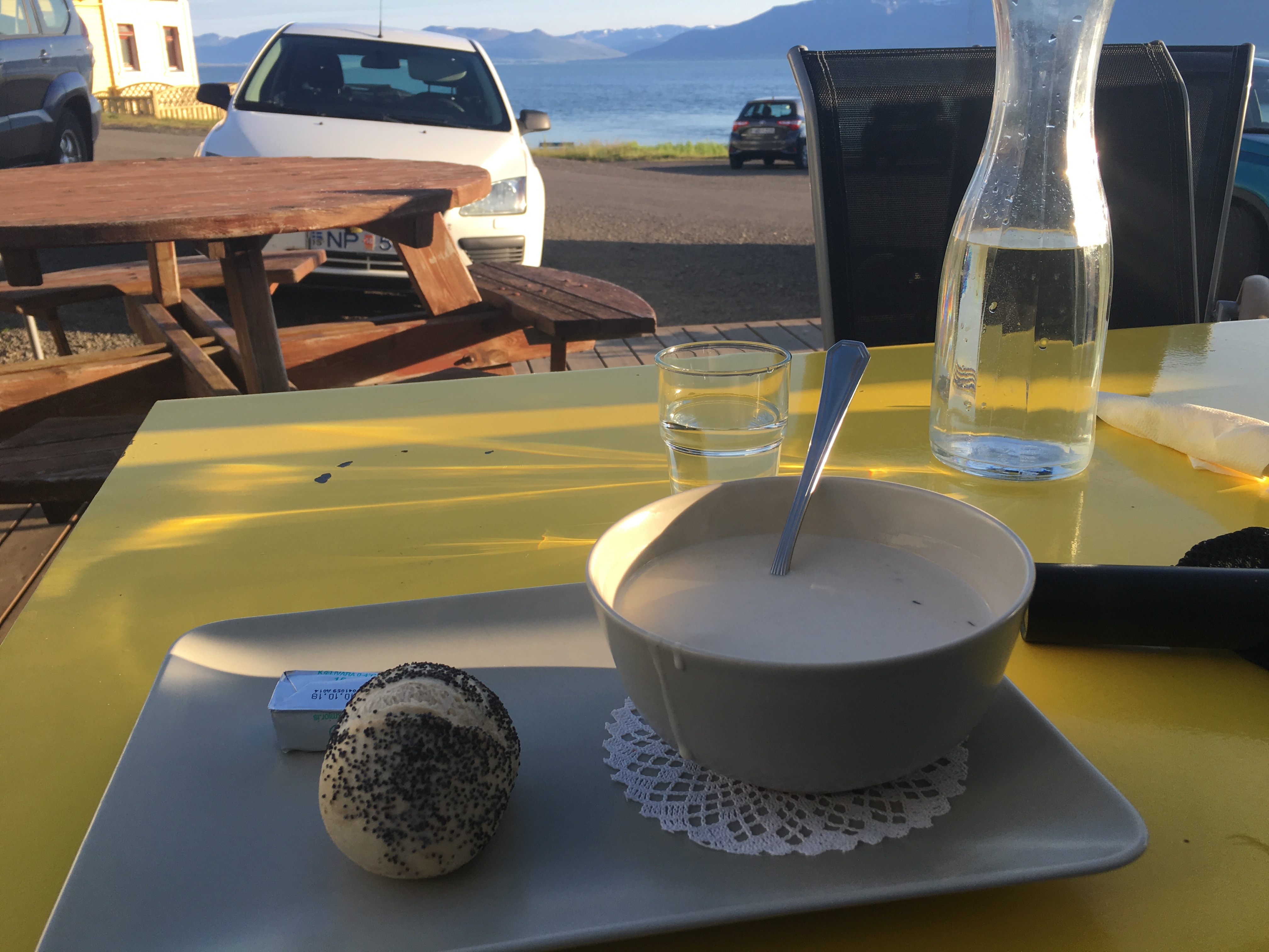
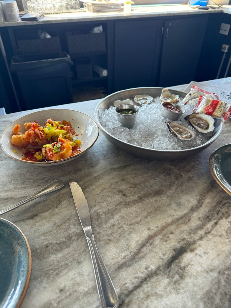
The oysters were tremendous as were the bang bang shrimp. Welcome to Charleston. Delicious.

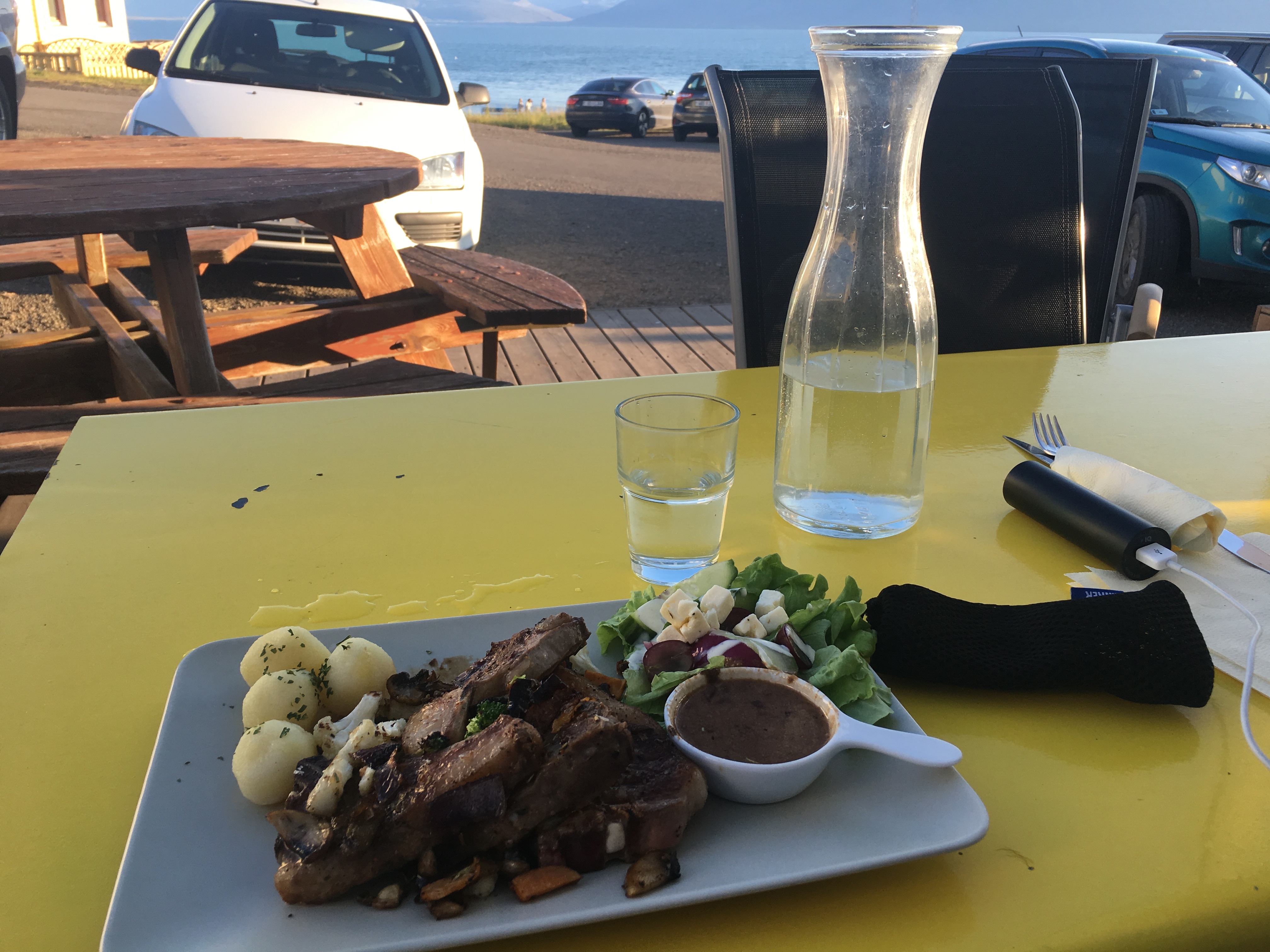
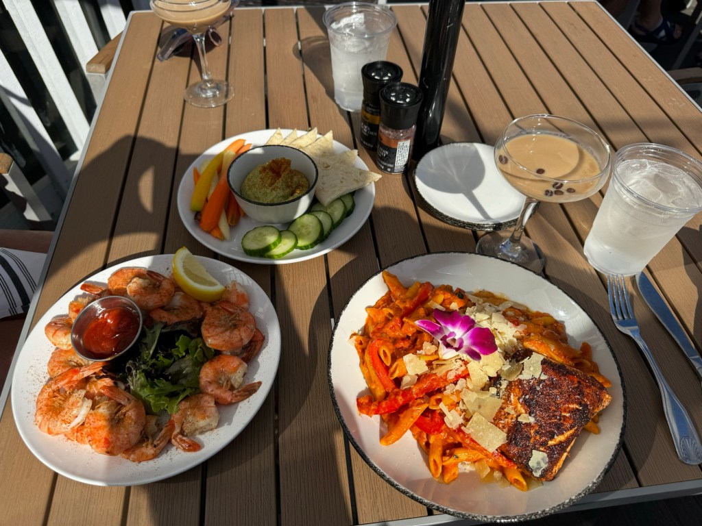
Once it was 4p, we headed across the bridge again back to Water’s Edge. We got a patio seat overlooking Shem Creek on a balcony seat and had some amazing pasta salmon and shrimp. We also had to throw in our honorary espresso martini. Shoutout to my other cousin Janelle that was throwing the down like Tic-Tac’s on our Cozumel trip all week. Here’s to you, Janelle, thanks for starting the trend and we’ll keep it alive and well for ya.

While chilling at sunset, some live music started up to our right in the bar area of the hotel. Perfect night cap to a busy travel day but the wakeup call at 2:15a Central Time was wearing on us. Time to Uber back, grab some sleep and wake up and hit Isle of Palms Beach.

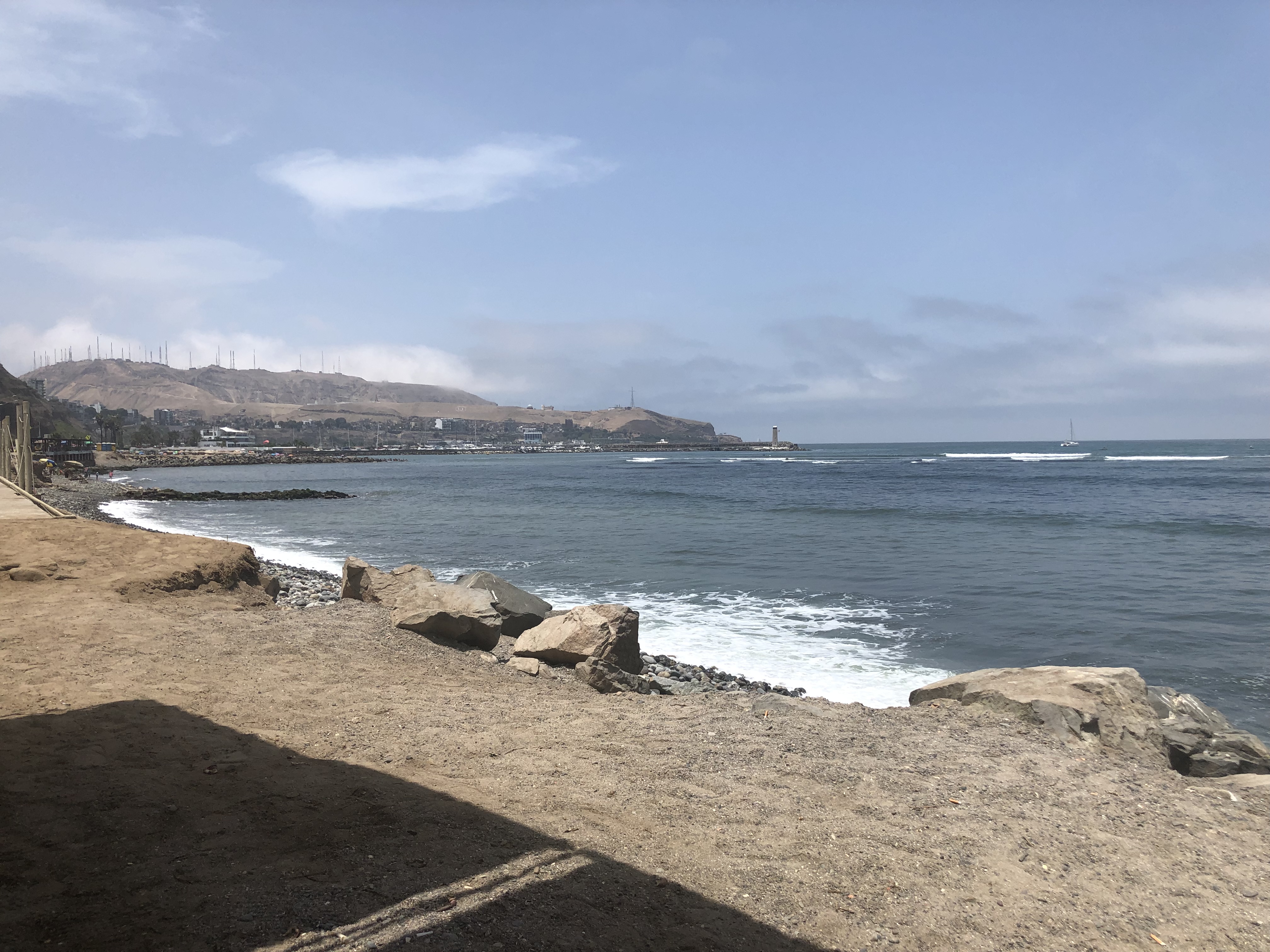
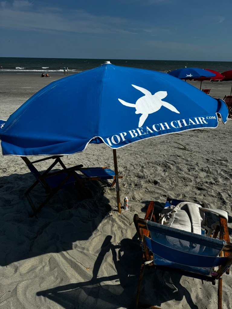
Isle of Palms is where Shep lives from the Bravo TV reality show Southern Charm. He’s got a beach house and I’d seen various scenes of how quiet and relaxing it can be there. In the morning I called a company to have our umbrella and chairs setup on the beach so that when we got there, we could just start the relaxation. It was only $44 for the entire day and I called at 9a and they had it ready by 10:30a on the beach with my name on it and called when it was ready. Heading to the beach on a Thursday was a tremendous idea already. Fantastic decision.

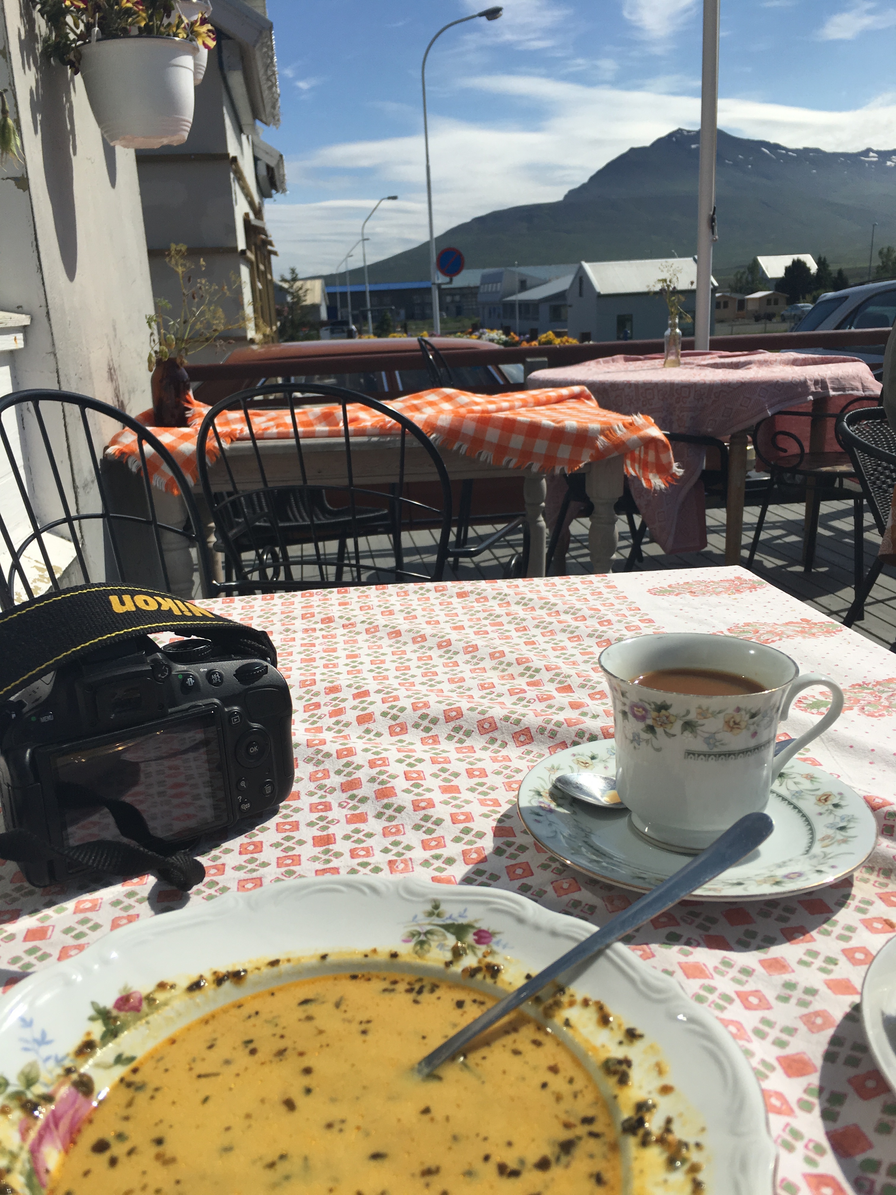
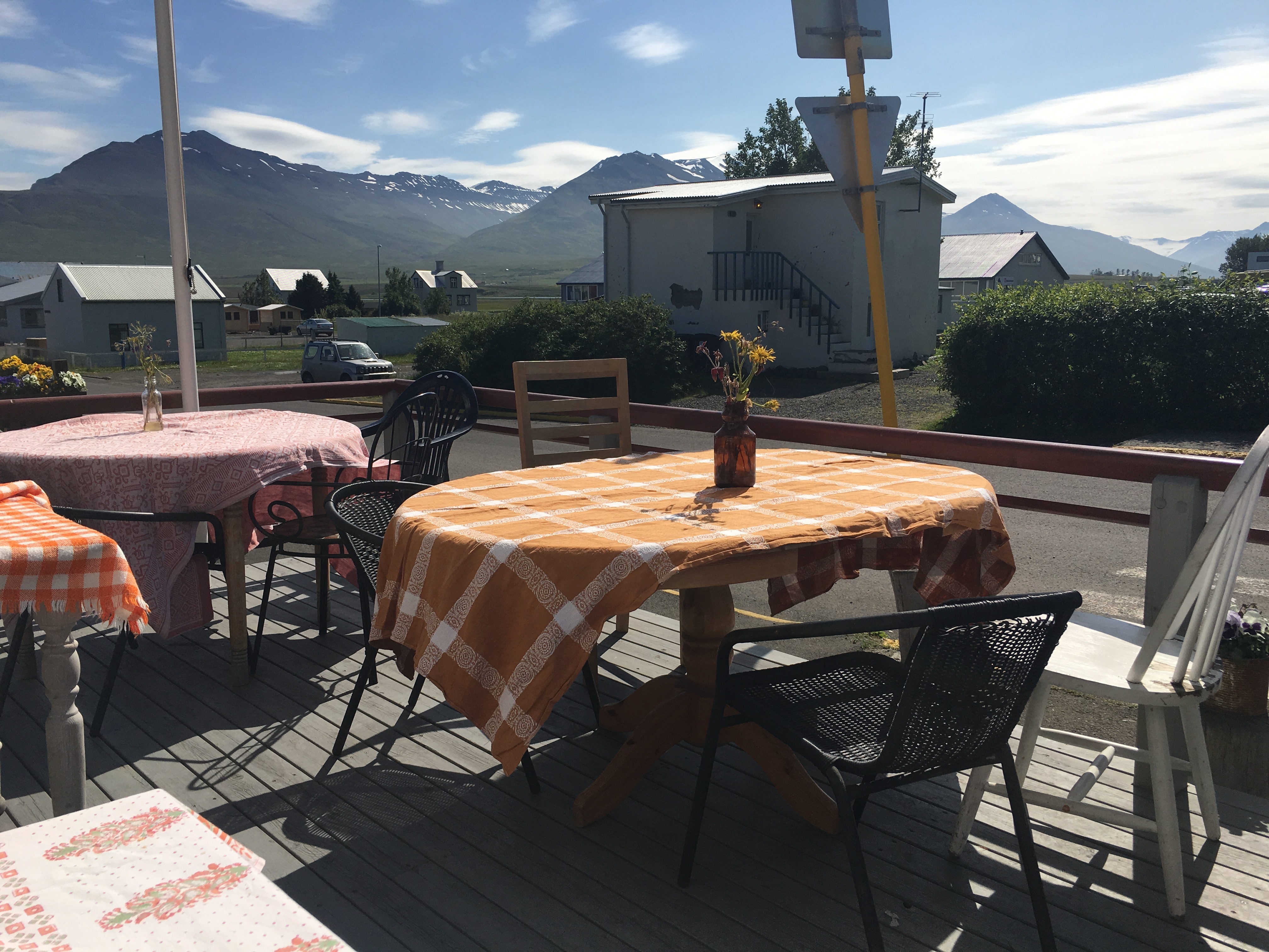
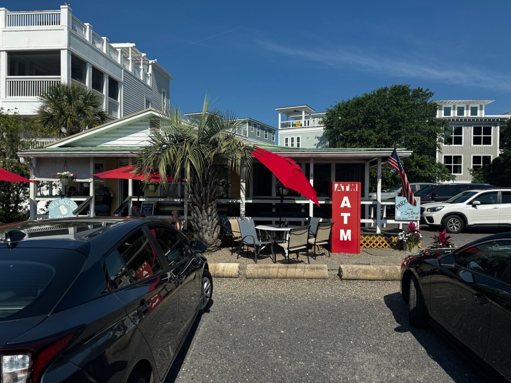
Before hitting the beach, however, I looked up a close breakfast cafe in walking distance of where our beach access point was at Coconut Joe’s. I found the Seabiscuit Cafe and it was the perfect place. Such a great idea to Uber as well as parking is at a premium around the beach, especially around the holiday. We walked right on over and got a seat outside.

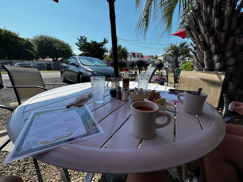
Perfect breakfast morning view with our coffee and birds flying around. They love picking food off your plate if you leave it unattended for too long. One bird flew in and stole Nicole’s bread.

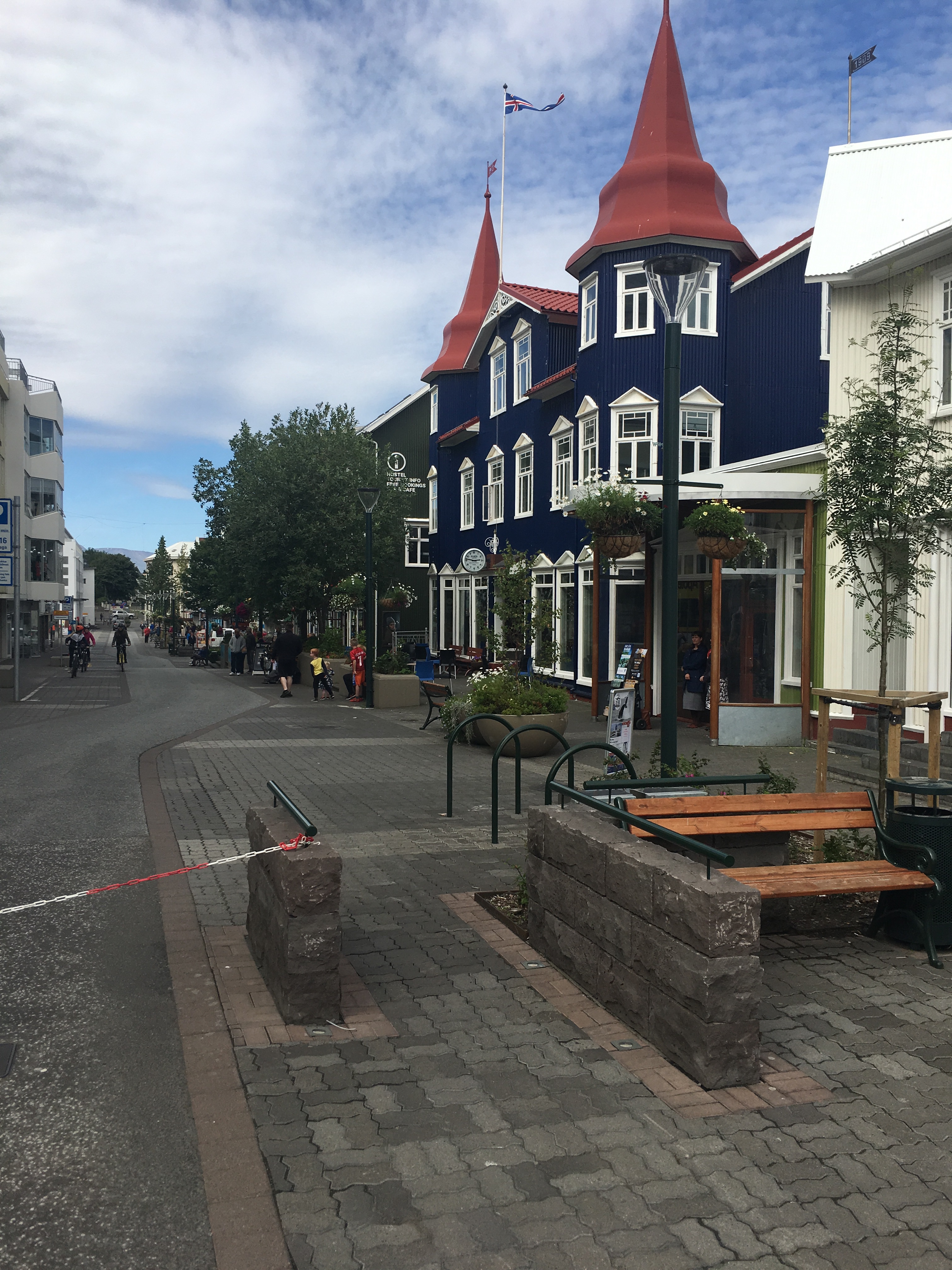
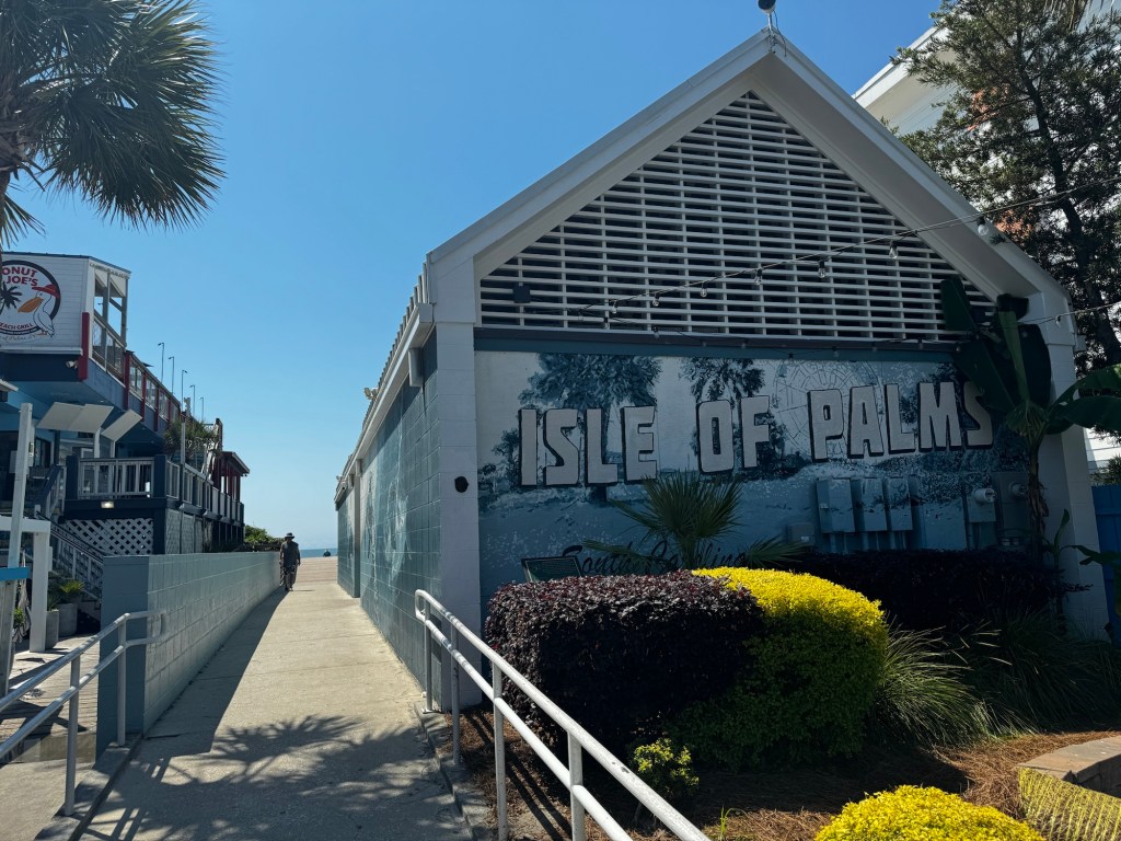
A quick 3-4 min walk down and around the corner and it was the main street of Isle of Palms. Filled with your typical beach stores and small restaurants and bars. I would much rather go here than Folly Beach where the tourists line the streets.

Here was our beach access point that was just to the right of the pic above.

We walked around for a couple of minutes and found our umbrella and chairs. After about 30 min we decided to have them move us closer to the water instead of the back area behind other umbrella’s. They gladly moved us over after going to grab their drill. This truly is the way to go.

The rest of the day time of our first full day was spent taking in the sun, relaxing, reading, listening to music from my portable speaker to some Stick Figure (always) and looking forward to dinner reservations that night at NICO Oysters and Seafood Bar. NICO was a former Pizza Hut building that was transformed near Shem Creek by one of the women on the Bravo Reality TV Show’s family. It was Naomie Olindo’s dad that started up the restaurant after moving the family from France many years ago. He owned a bunch of restaurants in France prior moving to Charleston and they also own Saltwater Cowboy that is a restaurant/bar on Shem Creek with vary different vibes. That is more a college-type hangout with amazing rooftop views of the creek. NICO is much more upscale and classy with an patio on the side that is covered with another bar. I’ll go into that restaurant in my next post, but wanted to kick things back off with my travel blog again since it’s been wayyyyy too long! Until the second post of Charleston on the night of day 2, cheers!

A Belizean Paradise and Adventure – Part 1

Tucked just south of Mexico in Latin America lies a largely undiscovered country that is becoming more and more popular by the day. This is due to the rise in flights coming from the United States that arrive daily from United, American Airlines, Delta and Alaska and then seasonally from Southwest, Sun Country, JetBlue and Frontier.

Due to the amount of flights arriving daily from the United States, this offers flexibility on travel dates and keeps the affordable cost. I was trying to get SCUBA certified in the Caribbean and I had heard amazing things about the Caye’s just off the coast of Belize.

In researching the best PADI Certified diving center, I stumbled upon http://www.splashbelize.com that has fantastic Google reviews and I started emailing Ralph that is the email main contact there. I had already taken the online PADI certification test last year when I was planning on getting certified in Maui for my confined and open water dives. You have to go through a PADI certified local location in order to get access to the online PADI portal. I went through https://www.kcdiveshop.com here in the KC Metro at 7300 W Frontage Rd in Shawnee, KS. I never actually stepped foot in the location, but called and emailed John the owner to get met setup online. I decided to do my confined and open water dives spanning two days in the ocean, I mean why do it in a pool locally when you can do them all in the ocean?

The Splash Dive Center in Belize was extremely responsive and helpful in getting me the forms to fill out and return and reserving my spot over Memorial Day Weekend 2023. They focus on a very individual approach where they only allow two trainees per instructor, so you really get that one on one attention. I filled out my health forms/waivers, credit card info to reserve (they don’t charge you until the class is over) and they even pick you up if you are within relative distance to Placentia Village in southern Belize.

After I knew that I was all setup for SCUBA classes, I could get into the nuts and bolts of where I was going to stay, what else I was going to do and fill in the gaps on my solo trip. I always, always start searching on Airbnb first, then I’ll venture to Vrbo and then hotels. I found the perfect Mermaid Cabana owned by a couple Ron and Flo in Placentia Village within seven minutes of Splash Dive Center.

Placentia Village is 2.5 hours south of Belize City where all International flights depart and arrive. So, I had to search for rental cars and found out Costco does not offer rental cars internationally, which was usually my go-to to save about 40-60% on each rental car rate through the travel portion of their app or website. So, I started by seeing who is all available at the Belize airport, and Avis was the cheapest, by far. They were $150-$200 cheaper than Enterprise, Hertz, Budget and others. For six nights, seven days, it was in the mid $400s to rent from Avis. The rental car agencies are directly across the street from the main Belize airport, called Philip S.W. Goldson Airport. The airport is the fifth busiest in Latin America, but you’d never know it. It’s a tiny airport with only a handful of gates. They just extended the runway, but the runway is so short, after you land, you have to do a U-Turn to go back to the gates and deplane. it’s very traditional where you can deplane on both the back and front of the plane and it’s down a staircase directly outside, there are no gate bridges.

The customs area was a little hectic being in a small room with a single guard giving the “go-ahead” to approach the customs agent. It was typical processing and stamping and asking where you were staying in Belize. Super easy to breeze through after that as I always carry-on and sped through the baggage claim area.

They gave me a Mitsubishi Outlander SUV for my stay at Avis and it had only been driven five times they said. So, it was brand new, bright red, and they hadn’t even gotten the license plate yet and the certificate was in the glove compartment in case I got stopped. There aren’t many highway patrols in Belize at all, so “Speed Humps” are the main speed protector in the country. They are mostly around areas of round-a-bouts, bus stops, entering cities and intersections. Especially when you enter the Placentia peninsula, there are over 20 speed humps along the 22-mile span of the peninsula. The main highways, not so much until you approach one of those locations I mentioned before, but villages and towns, yes. There aren’t many highways in Belize, but the ones they do have are paved and perfectly safe. I hear they are slippery when it’s raining and wet, but I never experienced rain and driving but I hear to go slow due to the pavement materials they use that slip. The drivers seemed to obey normal American driving rules, but you’ll see trucks carrying many passengers in the truck bed from time to time as they carpool a lot Gas is about $15 per gallon down there, so it’s not cheap. They get a lot of their materials from Mexico, they have no oil refineries in the country, so Mexico gauges them a bit that they buy from. They also get their electricity from Mexico. I was able to make it to Placentia Village in about a half tank of gas that was completely full when I left the airport. You have to pay a $5 Belize dollar fee as you leave the rental car agencies lot that is a tax they have. For every $2 Belize dollars, it’s $1 American dollar. So this was $2.50 in American money and they accept the American dollar everywhere you go, but just don’t expect to get change in American money, they’ll give you Belize currency for your change.

Try and take the Hummingbird Highway on the route down to Placentia Village, it’s the most scenic inland. I hear that really the only crime in the country is based in Belize City, so to avoid that area and never drive into the city as I hear it’s chaotic. They do have a domestic airline that can fly you in propelled planes down to Placentia Village on Mayan Island Air and it’s around $100 for about a 25-minute flight each way to a small airport and then you can rent a golf cart or moped or car while down in Placentia. I wanted to explore the countryside of Belize, so I opted not to do that, but that is possible and I saw flights coming and going and drove by the airport in Belize many times. Great alternative to those that want to speed up getting to Placentia Village and can find the right arrival and departure times.

Placentia is a peninsula that spans 19 miles in southern Belize. This is the relaxing side of Belize, away from the hustle and bustle of the capital in the north. The capital is actually in Belmopan as they moved it inland in 1970 from Belize City after a hurricane. Belize City is only a few feet above sea level, so it’s very susceptible to hurricanes and flooding. You’ll see a lot of houses on stilts even so far inland as Belmopan. You’ll drive through Belmopan on your way to Placentia Village. This is where a majority of the jobs are located, car dealerships, gas stations, but there are no fast food restaurants. Everything here is locally owned and authentic, which adds to the local appeal and charm. Most of the residents I talked with are from Guatemala that borders Belize to the west, or from smaller, remote villages in Belize. There are 100% blood Mayan residents still in Belize as I bought a jaguar tooth necklace from one of them located near the southern pier and they have their own villages scattered around the country. There are some from Honduras as well that boat over every day for work. Very few actually live in Placentia Village, but they carpool in with others or buses to work everyday.

Jaguars are regarded very highly in Mayan culture as the most vicious predator of the jungle. They have the strongest chomp of any animal in the jungle, even the lion and tiger. They have a 1,500 pounds of force for every square inch due to the shape and structure of their jawlines. This is double the force of a tiger! This is strong enough to break the skulls of their victims and even turtle shells. While most animals go for the neck to kill their victims, jaguars just crush skulls. They are lethal and very territorial. If you invade their habitat area in the wild, they will hunt your livestock on your land since that is seen as their territory still, even if you get rid of trees from the jungle. Many villages had to go through this when the country expanded and they started losing livestock to jaguar maulings.

I didn’t include photos in this blog since it had been so long since my last blog post and I just wanted to get another one out there. Adding photos takes up the most time to upload and insert and takes about two hours to post each post, so I’ll try and do that in the future. This is part 1 of a multi-part Belize adventure I took over Memorial Weekend this year, and I’ll have Part 2 hopefully very soon and the story will continue. Until then, I encourage you to research Belize on your own as well if you get the time, it’s a fascinating country that is growing in popularity every day.

How to travel to Hawaii during pandemic

It’s been six months-to-a-year since I’ve last blogged. Not because of the pandemic or because I haven’t traveled, but mostly because my new-ish job has me dead tired by the time I get home every night. I’m sure most every job during the pandemic has people working ten times as hard. Over the holidays in 2020, I decided I needed a tropical escape and recharge. I had just came back from Newport, Rhode Island for a December colonial holiday filled with mansions, Brown University, Yale University, the oldest working library in the US, Cliff Walks and wharfs, but I’ll explain that trip in a separate blog.

I always kept abreast and follow Southwest Airlines for any new destinations. I just signed up for their Chase credit card to receive 50,000 points if I spent $2,000 in the first three months, receive 7,500 points on my card anniversary and has an annual fee of $175. I could also get another 30,000 points if I spent $10,000 in the next nine months. I would sign up for this after booking my Hawaii trip and never regretted it. You can find the card here: https://creditcards.chase.com/a1/southwest/NAEP40kPriority321?CELL=6MB9&jp_cmp=cc/SWA_Brand_Exact_SWA_SEM_US_NA_Standard_NA/sea/p25772051396/Southwest+Card&gclsrc=aw.ds&&gclid=Cj0KCQjwjPaCBhDkARIsAISZN7RJoenp38vWhWAn5HXfCFTj3cQb3XhbO71JZ_SnLnFLlG1HUNruThUaAn5-EALw_wcB&gclsrc=aw.ds

Anyway, Southwest was adding a route from Long Beach, CA to Honolulu. I always liked to break up the flights on my way to Hawaii as it’s typically three hours to Cali and then five hours to Hawaii. So, it’s always best to stay the night in Cali. However, the main routes from Cali to Hawaii are through Oakland, San Jose, San Diego and Sacramento. With this new route through Long Beach, I thought I could get cheap rates getting in early as they were starting March 11. I looked and they were about $375 ROUND TRIP from Kansas City. That is unheard of, usually it’s double that, especially around spring break.

So, I used some points I had already and got round trip for $309 through Long Beach. I had to go from KC to Phoenix and then Phoenix to Long Beach. I would stay the night where I picked up 2,000 more Rapid Rewards points at the Westin Long Beach and then would fly straight to Honolulu. I would depart KC on March 11 and depart Long Beach on March 12.

On the way back, I would fly Honolulu to Long Beach on March 17 and then Long Beach to Denver to KC on March 18. (I would later change this route because the Denver layover was 4.5 hours and the Southwest customer service rep told me I could fly to Oakland and have a layover for 45 minutes and go straight to KC and arrive 4 hours earlier at 2:30p in the afternoon. I jumped on that opportunity!

So, my flight was set, but now I had to figure out the pandemic and quarantine situation in Hawaii as it’s much more strict on the islands. They had a mandatory 10-day quarantine up until October 2020. It was supposed to happen in August 2020, but they delayed it and the governor stated in October that if you produce a negative covid test taken from an approved Hawaii Dept of Health provider 72 hours prior to your final departing flight to Hawaii, you can avoid quarantine.

So, this means you have to setup an account here with the state health department of Hawaii: https://travel.hawaii.gov/#/ After you set up your account, you enter your trip information such as flight number, days staying on the islands, if you plan on visiting other islands while there and other information. I would also highly recommend NOT island hopping right now. A friend of mine visited the Big Island, had to take another covid test onsite when he landed, then he tried going to Kauai and had to fly back to Honolulu for another test and wait for results and flew back to Kauai. He had to pay for the extra flight and tests back in Honolulu. What a NIGHTMARE! I knew about the issues ahead of time, so I decided to stay on Oahu and it had been 16 years since I stayed there anyway, so wanted to check it out again.

So, my departing flight from Long Beach to Hawaii left on a Friday at 7:20a Pacific Time, which meant I could take my covid test in KC after 9:20a Central Time the Tuesday prior. I knew I left for Long Beach on Thursday and wanted to make sure I got my test back in time in case I somehow received a positive test and had to cancel everything. There was no way I was going all the way to Hawaii to sit in a condo for 10 days trapped in quarantine. Another issues was making sure LA county in Cali would not make serve any quarantine for being an out-of-state traveler, so I confirmed I would not have to from the Westin Hotel I stayed at ahead of time.

So, I took my test at Walgreens at 95th and Antioch at 11a Central Time on the Tuesday prior to my flights, March 9. I did a rapid diagnostic test, but they will NOT ACCEPT the antigen test, so DON’T DO THAT ONE. Make sure it’s the Real ID rapid diagnostic. You have to schedule on the Walgreens site online three days prior and they order the test for you and it’s drive-thru. Super easy and only takes a few minutes. I got my results back via email in about six hours.

After receiving your emailed results, you download the PDF version of the negative test and upload it to the Hawaii Health Dept site and it’s easy to navigate. You also have to upload a recent photo of yourself and you can even take a selfie really quick and upload. That’s what I did. As soon as you upload the negative test, an automated software will review the PDF and then you’ll see a “COVID NEGATIVE” appear next to your upload. It will do this automatically after you upload. This MUST BE a PDF file. You can’t screenshot from your phone or have a Word document or anything else that says negative, you must make sure this is a PDF so the software can read it. It must say what kind of test it was, what business administered it, the date and time you took it and the result. It’s all on the Walgreens lab form automatically. Make sure you print a hard copy to have on you at the airport just in case! You can’t take the test in Hawaii and still avoid quarantine.

The final piece of the puzzle is filling out a health questionnaire 24 hours prior to your flight. As soon as I got to the airport departing for Long Beach from KC, I went to the site on March 11 and filled it out that morning and submitted. You will receive a QR code via email right away that you’ll use as soon as you land in Hawaii in the terminal after you get off the plane, along with your government ID. Again, they are super strict right now.

The morning of March 11, I had a driver from Leader Limo pick me up to take me to the airport. They are a part of the Accelerent business development group I’m a part of and I’ve been referring a lot of business from local hotels to them, so as a thank you and as a showing of what they can do, they offered to take me to the airport and pick me up, which was super nice of the owner Bruce Heinrich! If you ever need their services for yourself or clients or someone you know, they have a wide range of fleet vehicles for even Bachelor parties or a kids first day of school or anything. They mostly focus on executive travel. Angelo was my driver and he was 15 minutes early and you’ll receive an email confirmation ahead of time. I rode in a Chevy Suburban and it was a smooth ride to KCI.

My flight to Phoenix was packed and not a seat open. My flight to Long Beach was wide open, not as many travelers going TO California and LA County that is still pretty locked down. Restaurants are just now starting to open again, but only for outside dining. It was unusually chilly in Long Beach, in the mid-50s temp and rainy. It was warmer in the 60s in KC, so the trip was off to a chilly start. I specifically planned to get to Long Beach early to get some beach time in, but was definitely too cold for that. The airport in Long Beach is so incredible. It’s tiny and so easy to get around in, and find an Uber for pickup. It was about $30 Uber from airport to the Westin Long Beach where I stayed. I chose it since I’d get 2,000 points for one night Rapid Rewards booking through the Southwest Airlines site and paying in advance. Worth it!

The hotel was gorgeous and monstrous and in the middle of everything.

I checked in early and was starving so I found one of my fav seafood restaurants Gladstone’s that was a 7 minute walk away. I had only been to the Gladstone’s in Malibu and didn’t realize they had one in Long Beach. It was a restaurant my best friends Nate and Marisa introduced me to on my first trip to Hawaii 16 years prior in Malibu, so I had to try again and relive old memories. I would also go again later with my great friend Amber when we traveled to Nate and Marisa’s wedding together. But, that was in Malibu as well. The seafood was just as great as I remembered it!

After watching some college men’s basketball and conference tournament games, I walked around the boardwalk and the aquarium. Only the outside pool was open at the aquarium, otherwise, I probably would have paid to go in. The trail was right along the water and there were tons of bike riders, scooters and joggers. Tons of yachts docked right there in the harbor.

Even though it was a bit chilly, it was sunny out. I was running low on energy after getting up at 3:30a, so I grabbed an espresso at Starbucks on the way back to the hotel. It was super packed in the middle of the afternoon on a Thursday. Made me wonder what everyone did for a living in Cali? Most folks ordered on their app and simply walked in and picked it up. Ordering inside apparently is for the Midwestern travelers, which takes 100000 times as long.

I was zonked by the time I got back to the hotel and it had started to rain a bit again. I was looking up places that delivered and found a pizza joint that was rated best in Long Beach and they bicycle delivered to my hotel. So, I ordered and they delivered to the lobby. Was definitely tasty, but not the best I’ve ever had. It was called 4th Horseman.

My flight to Honolulu was 7:20a and my drive to the airport was about 15-20 min away, so I relaxed and got some sleep. A long flight the next day.

Got up early and was trying to find an Uber in the lobby of the hotel the next morning and literally could not FIND ONE UBER. I was trying for 30 minutes around 4:45a. I had some pilots and flight attendants staying at my hotel leaving in a van at the same time and I asked if I could hitch a ride with them and the driver wouldn’t let me saying she didn’t think the pilots would let me. One of the flight attendants said she could care less. But, right as I was denied, I accepted an Uber for 2.5x it’s rate. But, I got to the airport. Lesson learned, schedule AN UBER IN ADVANCE. My rate to the airport was $75! Ridiculous. I shrugged it off…I was going to Hawaii.

I was the first one in the airport that morning, not a single soul there. Telling you, this airport is tiny. The gate had tiny surf boards on it and lei’s. They had just started the route to Hawaii the day before. The airport is so small, you board outside.

I’ll end my blog here…..as I embarked on my five-hour flight to Honolulu. I’ll save more info for the landing and actual Oahu experience. But, this is a good set of rules and guidelines if you want to travel to Hawaii right now and the protocols you have to go through. It’s worth it and cheap airline rates! Until next time….book that trip!

A Rediscovered Incan Paradise

The sun battered our backs as the clouds slowly drifted by below us like a traffic jam in New York City.  But, we were far from any major city you could think of, away from civilization and cell reception.  Maybe this was the goal of Pachacuti Inca Yupanqui, whom was the ninth ruler of the Inca from Cusco and supposedly commissioned the site around 1450.  The land lay dormant from when the Spanish invaded the Inca in 1528 until Hiram Bingham rediscovered it in 1911.

By the time famed archaeologist Hiram Bingham rediscovered Machu Picchu, it was overgrown with weeds and trees and barely recognizable compared to what it is today.

See the source image

It took a full year to burn all the trees and limbs and weeds away to reveal the majesty that is Machu Picchu.  There are so many hidden gems in this structure, that there are whole books that try to cover it all, but cannot, I’ve read a few.  Some of them are Turn Right at Machu Picchu, Machu Picchu: Exploring an Ancient Sacred Center, and Lost City of the Incas by Hiram Bingham.  All are excellent reads.  The second one, exploring the sacred center, is pretty costly but the best place to find cheaper is used on Ebay.

The Inca worshipped the land.  They worshipped the mountains the most, then the rivers and streams and the soil itself.  They believed the mountains created good crop seasons with just the right amount of rain and sunshine, life’s perfect balance.

Image may contain: Burt Schreiber, Michael Hiatt and Chanel Fortier, people smiling, mountain, sky, outdoor and nature

It was supposed to be rainy season, but the sun had other ideas.  We had layered up not knowing what to expect on temperatures or precipitation.  We were told by our guide that “rainy season” doesn’t really exist anymore due to climate change.  It’s an excuse they use to shut down the Inca Trail for a month in February to repair and fix the bathrooms.  So, there you got on that little tid-bit.  We had never planned on doing the Inca Trail regardless.

The first site our guide took us to was the House of the Guardians.  These courageous souls protected the entrants to the city and were housed  in a stone hut on the hilltop overlooking the city, shown below, that is just above where we took the latest picture above.

Image may contain: sky, outdoor and nature

I specifically brought my Chiefs Kingdom red flag with me to take a picture overlooking Machu Picchu to post.  As I removed the flag from my backpack, another tour guide immediately noticed it was a flag, other than a country’s flag, and started yelling in Spanish.  This alerted my guide that spoke English and he rushed over to me to inform me that no flag pictures are allowed other than your country’s flag.  This is due to the respect of the land and the culture.  Bummer, but I get it.  I would later use the flag in converting an Eagles fan that was a local walking by as we ate crepes at a place across the street from our Airbnb.

Image may contain: Michael Hiatt, smiling, outdoor

We climbed back down towards the entrance gate to the city.  This was the last photo in my last blog post show the large rectangular-door like structure.  There was an actual door back in 1450, but today, it’s wide open with nothing.

Underneath the entire site of Machu Picchu is an ancient aqueduct that reaches into a nearby mountain spring and runs water throughout the entire city.  It’s a feat that guides are quick to point out and is extremely impressive.  I witnessed water still running in the various pools through the site.  It’s extremely dirty naturally, but the dang thing still works!  Unreal the Inca made something so perfect, it stands the test of time 100s of years.

The stones were plentiful with walls and small encased closet and storage spaces everywhere.  In most rooms there were small squares cut out in the stone that allowed vantage points of the view that would comprise a Modern Wonder of the World.

We weaved in and out of the stone walls that seemed like an endless path.  Around the corner, we were guided to a wall overlooking another hut below, but this one had no ceiling and we were not allowed to go down and enter, it was too sacred.  This was the Temple of the Sun.  In my last blog post, I discussed the sun’s rays beaming from the Sun Gate down through the windows of this structure to the the middle of the temple at the summer and winter solstice.  Coming from either direction.  The temple is below.

Image may contain: mountain, outdoor and nature

In this photo, you can see the window coming from the eastern direction.  There was a door that filled that curve you see that is open to the temple.  That door had a hinge and only the high priests were allowed inside the temple to present gifts to the gods, their most sacred treasures.  The door has since been removed.  The window that brought the sun’s rays from the Sun Gate is to the right wall of the temple of this picture, as the Sun Gate is a couple miles away to the right on a mountaintop.  A feat of architecture that still astounds, especially without the technology and tools we have today.

We admired the fine craftsmanship of all the stones in which you couldn’t fit a single piece of paper through the sides of the stones.  It was remarkable.  No words can justify what we witnessed.

Next on the tour was the Intihuatana stone located in the Sacred Plaza.  This stone is set at the highest point of Machu Picchu, and for good reason.  Without knowing anything on the placement or degree of curvature, you would pass by this stone without second thought.  It was strategically placed in between the four mountains that were placed in each direction around Machu Picchu.  The name “Intihuatana” actually means “To tie up the sun” from the Quechua language, the language of the Incas.  The Inca believed that the day the sun never rose, was the day all life would cease to exist, so they devised a way for the sun’s shadow to form harnesses on the ground, therefore “tying” the sun to the ground so that it would always stay in the sky.

The stone is set high upon the Sacred Plaza, above a tiered, pyramid setup.  Through its high elevation, it is thought to connect the different levels of the Inca mythology (Hana pacha, Kay pacha, Ukhu pacha; Spiritual World, Now, Underworld) in one focal point.

The sacred plaza around the Intihuatana stone in Machu Picchu

Its primary function was most certainly astronomical. It looks a bit like a sundial, and that is actually not far away from the truth. During the two equinoxes (so March 21st and September 21st) the sun stands directly above the Intihuatana – creating no shadow whatsoever. This is only possible because the upper part of the Intihuatana stone has an inclination of around 13 degrees. The fact alone is marvelous since similar stones in the area of Quito didn’t require this angle and hint at the grand depth of the astronomical knowledge of the Inca.

Here is  a picture of the famous stone up close:

Image may contain: mountain, cloud, sky, outdoor and nature

I had read that not long ago, someone was filming a movie on the site and one of the crane’s holding a camera fell on the stone and cracked a piece off.  Large cameras are now prohibited in Machu Picchu.  I can’t imagine someone or a company being so careless on priceless history.  The Intihuatana is often wrongly associated with the solstices – but that is a myth. Only the Temple of the Sun (a few hundred meters away and in pictures above) casts an auspicious shadow on that date. The Winter Solstice festival is known as Inti Raymi and is still being celebrated in Cusco each year.

William Prescott possible wrote something about the Intihuatana way before, in 1847 to be precise:  “The period of the equinoxes they determined by the help of a solitary pillar, or gnomon, placed in the center of a circle, which was described in the area of the great temple and traversed by a diameter that was drawn from east to west. When the shadows were scarcely visible under the noontide rays of the sun, they said that ‘the god sat with all his light upon the column.”  This was shocking to me, because I originally felt they did this for the shadows, but the real meaning came from the sun being placed directly overhead so that all the beams were being cast upon the stone itself, hence no shadows at all.  Amazing.  These stones are placed in other Incan sites around Peru, this is not the only one.

The next destination was a rock cut-out of the landscape behind it.  You were not allowed to touch this magical rock anymore, but a few of us, including me, did anyway.  It is said there is magical powers of the rock for all whom touch it.

Image may contain: 1 person, smiling, mountain, sky, outdoor and nature

The jagged edges at the top represent the mountains directly behind the stone on an adjacent mountain range.  The craftsmanship is unlike anything I’ve ever seen.  You can see a glimpse of the adjacent mountain in the top left portion of the picture in the background.  You can see the peaks match with the stone carving.

The hike around the sacred grounds were tiring, especially when you are at 7,700 feet and 3-4 layers on and 80 degrees.  We were given some time to sit and relax on some rocks and down some water to recharge for the walk back.  We were on the far end of the site, farthest away from the entrance.  There were quite a few others taking a break as well from their own tours.

Once we got going again, it was more a straight shot back.  We stopped mingling with alpaca’s.  There were right next to us on the way back and other tourists were feeding and petting them.

Image may contain: one or more people, mountain, sky, outdoor and nature

Image may contain: 3 people, mountain, child, outdoor and nature

This about formally ended our hike of Machu Picchu.  We had seen the major areas of attraction and our guide was fantastic. There was only five of us total on the tour, not including our guide and our party of three was a majority of it.

The bus was easy to catch back down the mountain to Aquas Calientes.  Before our tour was over, our guide pointed us to Mapacho Craft Beer Restaurant overlooking a raging river and said it was the best in town.  The food and view was spectacular.  The one mistake I made was ordering a frozen alcoholic beverage, forgetting to never drink water or ice in Peru.  I would have stomach problems all night long later that night.  So, lesson learned, ugh.

Here is the view of our balcony view of the raging river, and man was it raging.  You can also see the aforementioned culprit to my stomach issues.

Image may contain: outdoor

Image may contain: mountain, sky, outdoor and nature

Image may contain: mountain, outdoor and nature

Our dishes were delicious, much more delicious than I was expecting for a restaurant on a main strip in the middle of nowhere.  I had the alpaca on the left with noodles.

Image may contain: food

We happened to run into a father and son we met in the airport in Lima heading to Cusco.  His son had moved to Lima for work from NY and his father had come down to visit while he had some time off.  Always great running into fellow Americans while traveling abroad and getting travel tips and updates on their journey.

We still had some time to kill, so we ventured around the local flea markets as there were tons.  Chanel and Burt bought their kids some items, I bought another magnet for my fridge to add to all my destinations I’ve traveled to.  My grandma always did this and I’ve always done it, and it’s something I try to do whenever I can.  My fridge is now stocked with them.

There was live music back at the train station as we waited for our train.  We sat front row and vegged out.  We were hot and tired and we’d done a TON of walking all day, especially after getting up before the sun rose.  It would be a sleepy train ride back to Ollantaytambo, then van ride back to Cusco.  The same exact route back that we came.  I didn’t want to miss another venture into the Amazon on the train, but I was zonked out in a matter of 20 minutes.

We disembarked the 360 Train on the Inca Rail and found our driver of the van taking us back to Cusco.  This would be another 90 minutes in the van and we arrived back in Cusco after the sun set.  We still needed dinner when we got back and our first choice was closed, so we ended up across the street from the original restaurant and they had some live music.

They were playing La Bamba in their native tongue…it was awesome.  I just wished they had played longer.  Clips are below:


After dinner, we walked around the main square in downtown Cusco.  There were street vendors everywhere and we wished the huge church was still open, but it was closed.  The square was lively.  Chanel bought a great work of art she took home with her.

Clip of the main square below:

It was an epic first full day in Cusco, the Incan capital.  We were excited for the second full day with an ATV tour of the Sacred Valley, ziplining over the Sacred Valley, more ancient ruins and the salt flats.

More adventure awaited us….join us in the next blog post……


Into the Incan Capital

It was a long day.  We were tired and sweaty and in a South American country.  We had already checked out of our Airbnb with no comfort of our own space, but we loved every second of it.  We had just arrived at 1a coming from the USA and were already looking to board a domestic South American flight later that night to enter the Incan capital of Cusco, going from sea level to 11,152 feet in a matter of 1.5 hours in the air.

Latam Airlines  is the largest domestic carrier in South America.  You cannot get to Cusco by any United States airline, and driving around the Andes mountains would take over 27 hours.  With a limited time in Peru, a bus wasn’t the best option.  Also, even the locals don’t recommend driving a bus through the Andes mountains, especially in February that is the “rainy season” as they consider it suicide.  There are a tremendous amounts of accidents along the roads in the Andes.  I can only imagine.

We arrived at the airport around 4p in preparation for our 6:16p flight to Cusco from Lima.  Our first stop was the Latam kiosk to check in.  I was the first to attempt to check-in, kept inserting my passport, but the system kept telling me I was not able to check-in.  The line was 5 rows deep bending back and forth and I was not checking a bag, so I was not exited about the prospect of having to get to an agent to simply checkin.  I could not get the system to check me in online either.  Both Burt and Chanel were having the same problems.  It was inevitable, we were going to have to wait in line.  Good thing we had arrived early.

We waited an approximate 45 minutes in line to find our ticket agent tell us our flight was oversold.  The good thing is that Latam Airlines flies to Cusco just about every hour.  So, they were able to get all three of us on the same flight an hour later.  We were just very lucky they had three seats left.  I’m not sure how you can build your business on constantly overselling your flights, but maybe if you are the only option.

We had some time to kill, so we ventured over to the airport restaurant, with it still being my actual 40th birthday, and we had dinner and they brought out a miniature cake and Burt and Chanel sang me happy birthday.  It was the perfect present.  Video below:

Not minutes after they sang me happy birthday, all the lights of the airport went out.  We figured, “here we go again” as we all know that travel plans never quite go according to plan and there is a ton of improv along the way.  My main concern was making sure we were able to be in Cusco by 5a to have our tour bus pick us up at our hotel.  I had to make quite a few reservations during the course of the day that were not refundable, tickets to Machu Picchu, train tickets, bus tickets to the city to get on the train and bus tickets to the top of the mountain in Aguas Calientes (meaning hot water in Spanish from the water that streamed down from the mountains).

Our gate in the airport was moved to basically the basement of the airport.  The lights were still out but there were flood lights on throughout the airport.  Most sat on the ground and my fear was that the flight was going to get delayed due to lightning and bad weather across the Andes, which frequently happens in February.  It’s not unusual for flights to get delayed and cancelled.  Luckily, we started boarding through the gate and we were directed to a bus outside that would drive us over to the plane.  It was congested, but to get to Cusco on time, I didn’t care, we were excited on the next adventure into the Andes.

We all had taken altitude sickness pills they highly recommend when you go that high in such a short amount of time.  They are pills you take 48 hours before you reach your elevation.  So, we’d all been taking them the last two days.  There are some side effects such as pins and needles and numbness in your heels and your taste buds don’t take well to soda.  Sprite tasted like a burning sensation, but figured it was a small price to pay to not be miserable for the three days we’d be in Cusco and Machu Picchu.  As it turned out later, we had zero effects of the altitude and the side effects of the pills were worse than the altitude, so I stopped taking the pills the second day in Cusco.  But, each person is different.  None of us had altitude sickness.

We started boarding our flight and I took a quick shot of Burt, he was pretty happy to finally get going.  We had been in the airport for almost four hours.

img_2574-1

The flight was quick and dark, so we couldn’t see the mountains below.  It was a bit shaky, but we made it.  Burt told the stewardess it was my birthday, so she came back with a small cake but no water to wash it down.  I asked for a water and she mentioned she’d be right back, but she never came.  This became a running joke for the rest of the trip how I kept wanting water but everyone ignored me.  This happened about five times.

The boutique hotel I reserved us at was http://tambodelarriero.com/tamboarriero/ and it was just like you’d figure a small South American boutique to be.  They had a car waiting with my name on a sign at the airport right when we landed.  I had called them and told them we were on a later flight so they were updated for pickup.  I’m sure they were used to it with the Andean weather patterns.  There are 10s of taxi drivers waiting to drive around all tourists and they try to lowball the rate if they can get a rate out of you.  Hard to beat free included with the hotel stay.

They had pressed coffee waiting for us when we arrived about 15 minutes later.  We checked into our room and we were exhausted.  We were on the second floor in the back of the hotel. The middle areas of the hotel were all open-air with birds flying around and plants over the balcony.  With a 4a wakeup call and a long day ahead, we’d have an early meal and hit the bed.

The entrance door to our hotel is below along a cobblestone street.

img_2590

Below is the main cobblestone street our hotel was located on.  We were a few blocks from the main town square we’d walk to another night.

img_2587

Here is the middle areas of the hotel

img_2583

The wake-up call came early, as did the tour bus.  We all showered and were excited for the grandest part of the trip, the journey to the Modern Wonder of the World in the Amazon basin perched upon a moutaintop, forgotten to the world until the turn of the 19th century by Hiram Bingham.  Overgrown with trees, they spent a year uncovering what would eventually reveal a paradise on Earth.  They would use fire to burn the branches, sometimes defacing the great architecture.

Here we are at about 4:45a drinking our tremendous Peruvian coffee.  The coffee in Cusco was unlike anything I’d ever tasted, so fresh.

img_2591

img_2584

Something about an adventure that makes 4a not seem so early.  With the unknown ahead of you that day, you can’t wake up early enough.

The bus was exactly on time.  I recommend using Trip Adviser to book your full day trip.  They take care of every ticket you will need all in a single price per person.  There are only a couple tours from Cusco, you can’t go wrong with either.  The bus was a small van with only another couple going on with us, so plenty of room.  February, even though it’s their summer in the southern hemisphere, is their offseason.  So, not many tourists and the perfect time to go.  They call it the rainy season, but we barely saw any rain and never had a downpour.  I think one night there was rain, but it was overnight.

The van ride was just over an hour to the town of Ollantaytambo.   This town was the start of the Inca Rail that would take us to the base of Machu Picchu and through the Amazon basin.  In parts of the train we’d be inside, and there was an observation car that was open-air to feel the Amazon breeze and watch the river rapids.  There was glass throughout with 360 views, which is why I chose it.  The 360 was the newest train they had and there are three trains to choose from.

The van will take you through small towns en route to our destination, up and around hills, sometimes bumpy, but worth it.  You watch the sun rise over the mountains.

img_2622

Ollantaytambo is a small town with the station.  There are vendor booths with locals selling products for tourists, from ponchos to food to Inca Kola.  This is their local pride and joy.  I couldn’t taste it well due to my altitude sickness pills.  So, I can’t tell you the exact taste, but from what I could tell, it was in between a Sprite and Coke with more tang than I cared for.

img_2601

The small town had a beautiful backdrop of mountains on a cloudy day.

img_2600

img_2607

We waited for two other trains to leave before our 360 train arrived and was boarding.  We bought some fresh and hot breakfast at the local bakery.  We checked out local bed and breakfast hotels they offered in the town.  It was a true South American gem of a town.

img_2597

img_2616
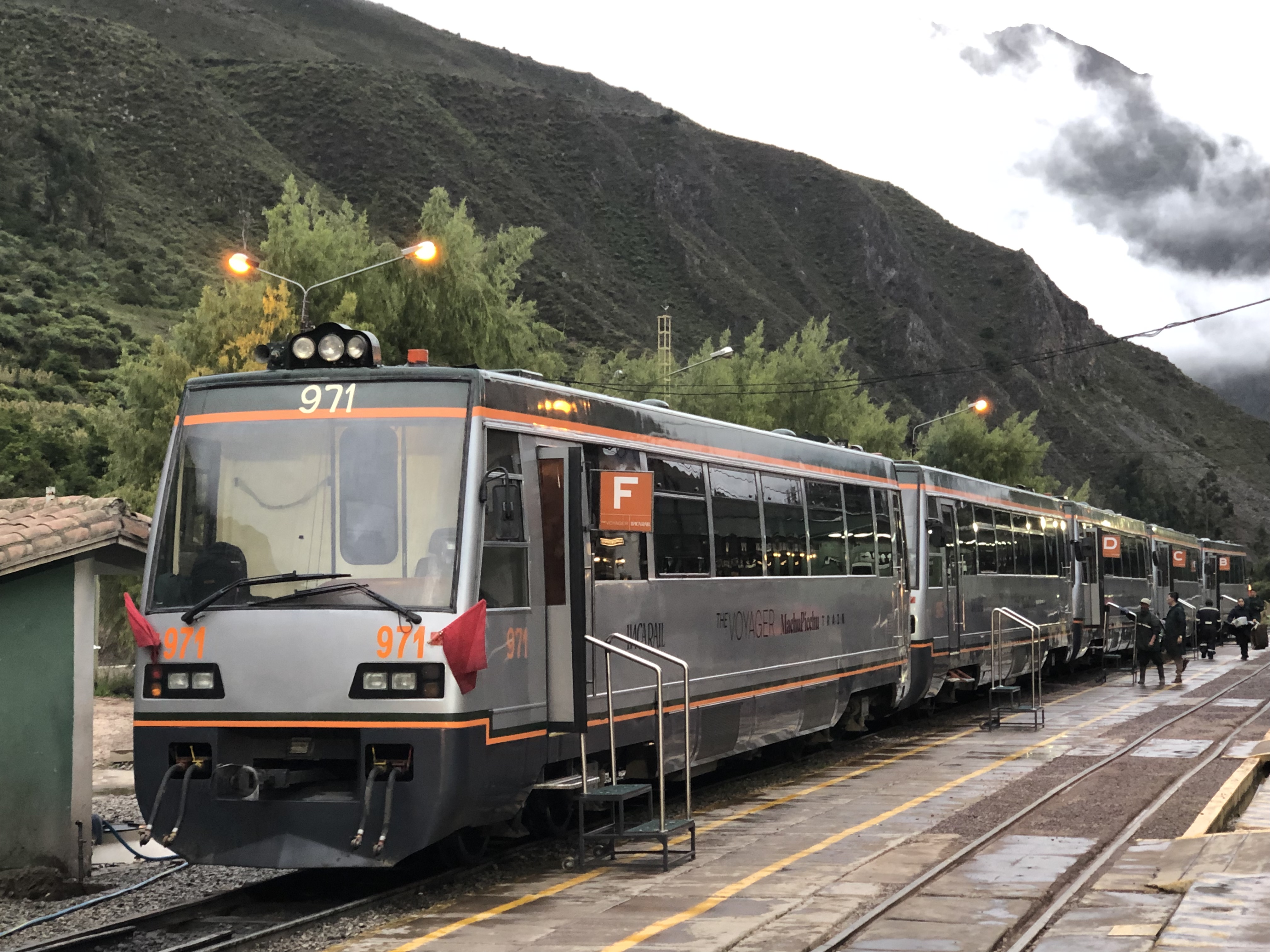
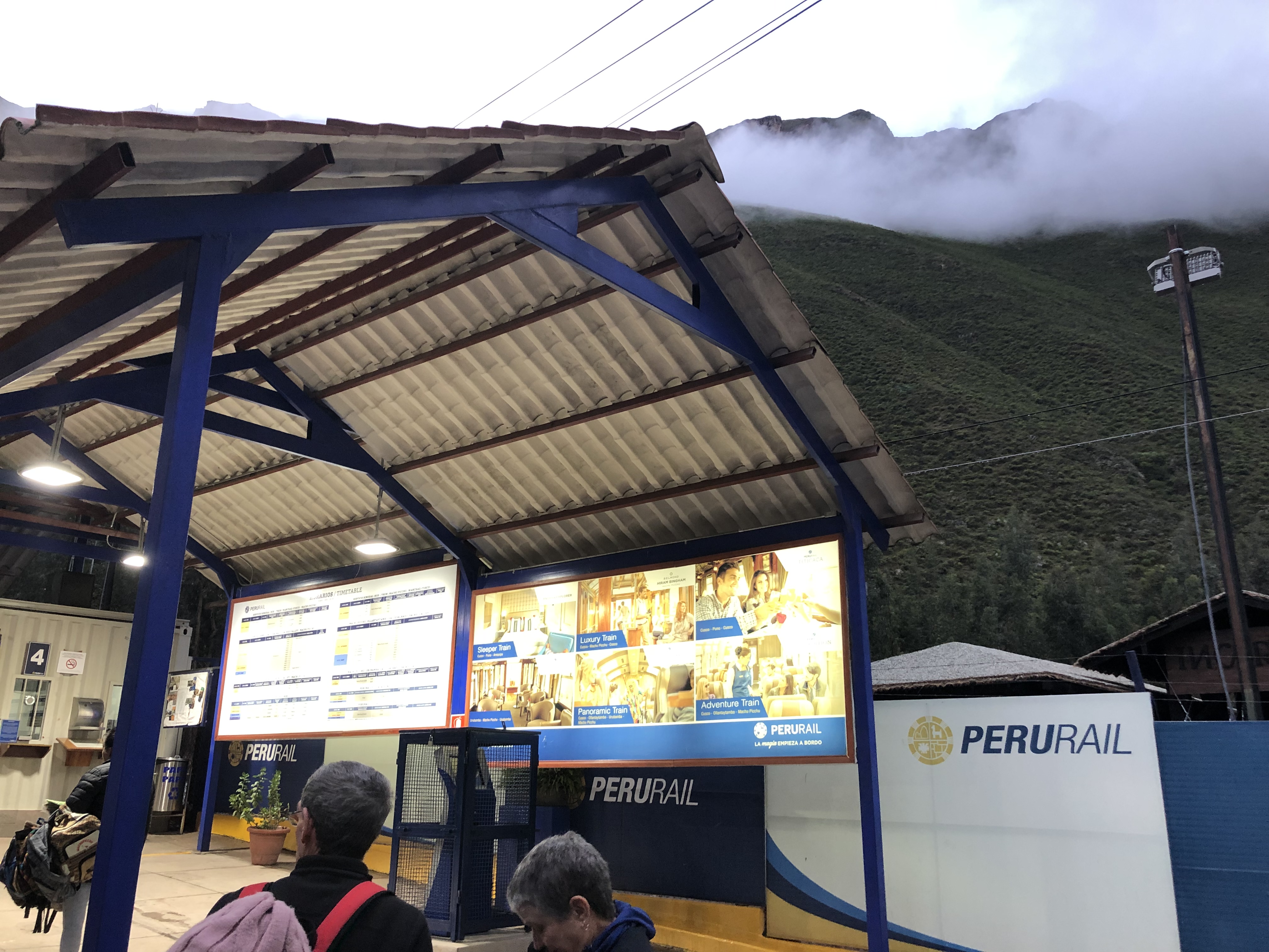
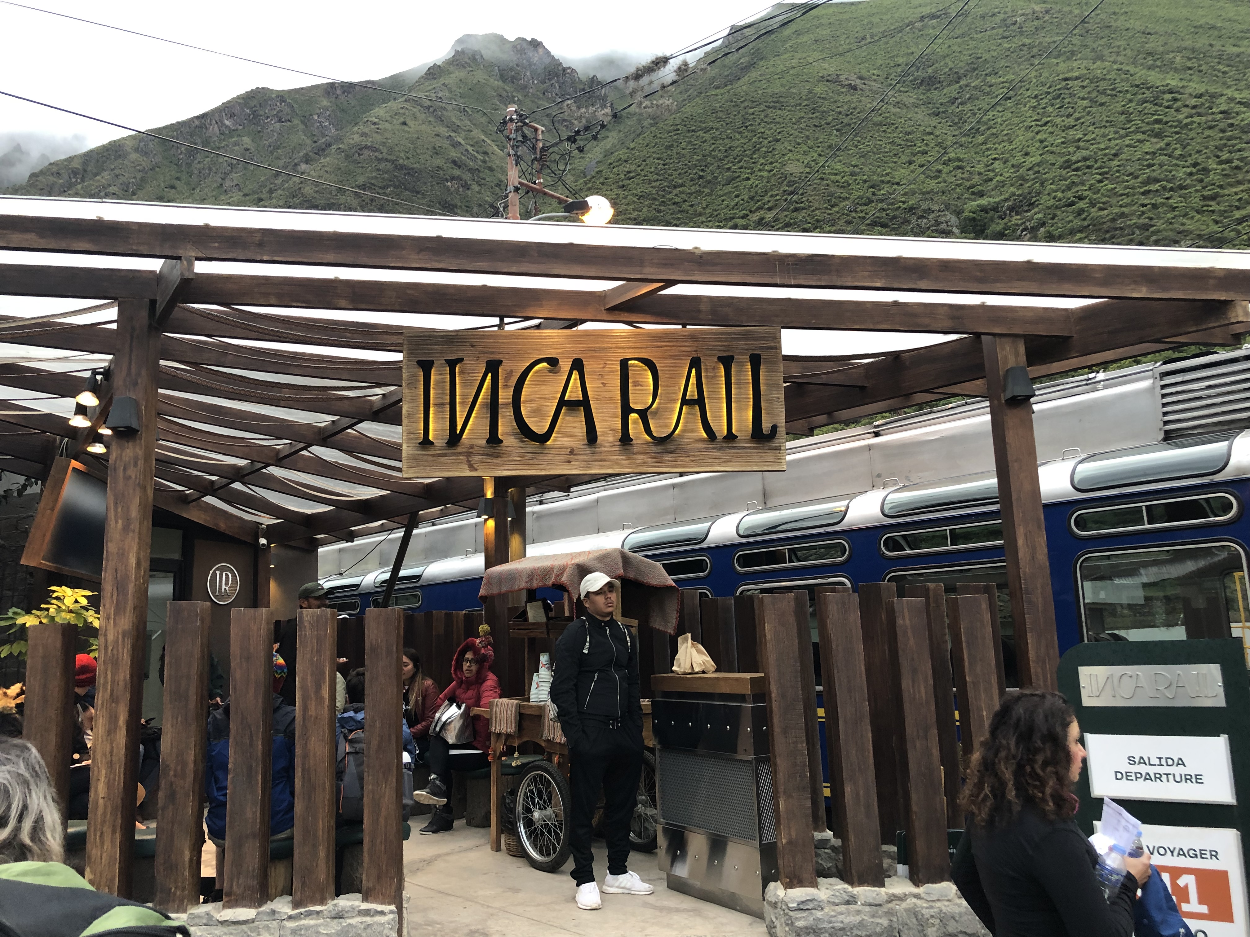
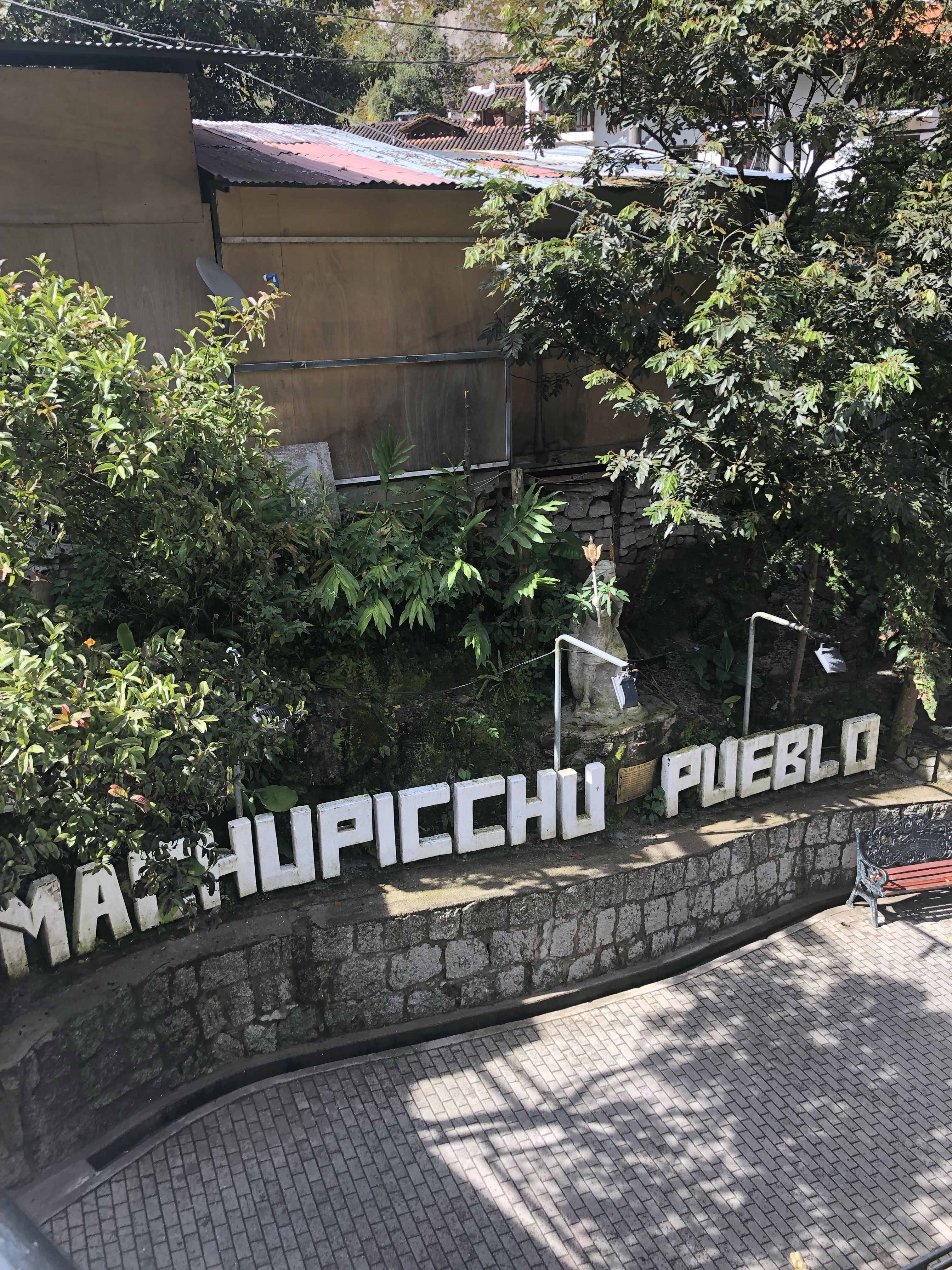
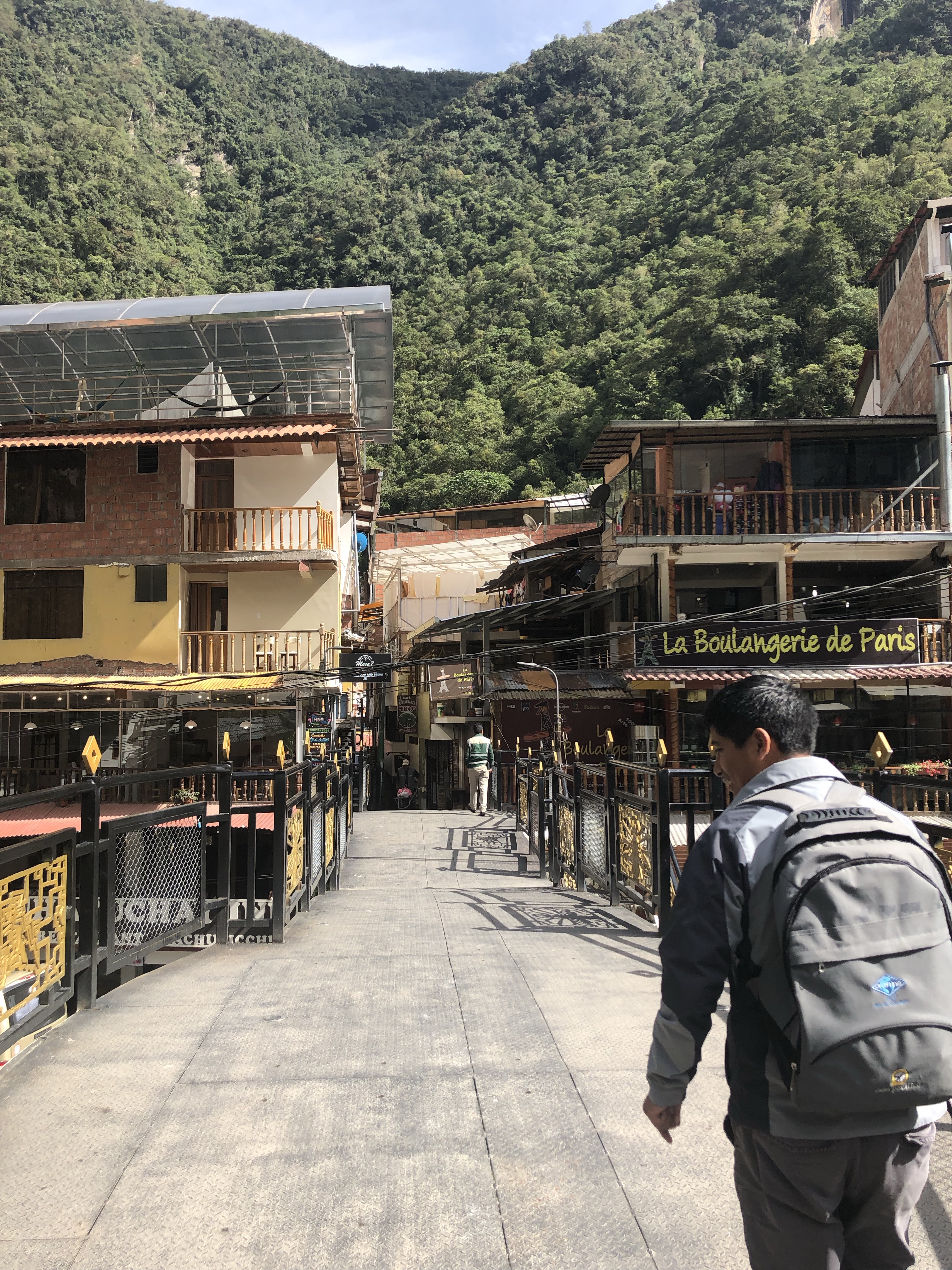
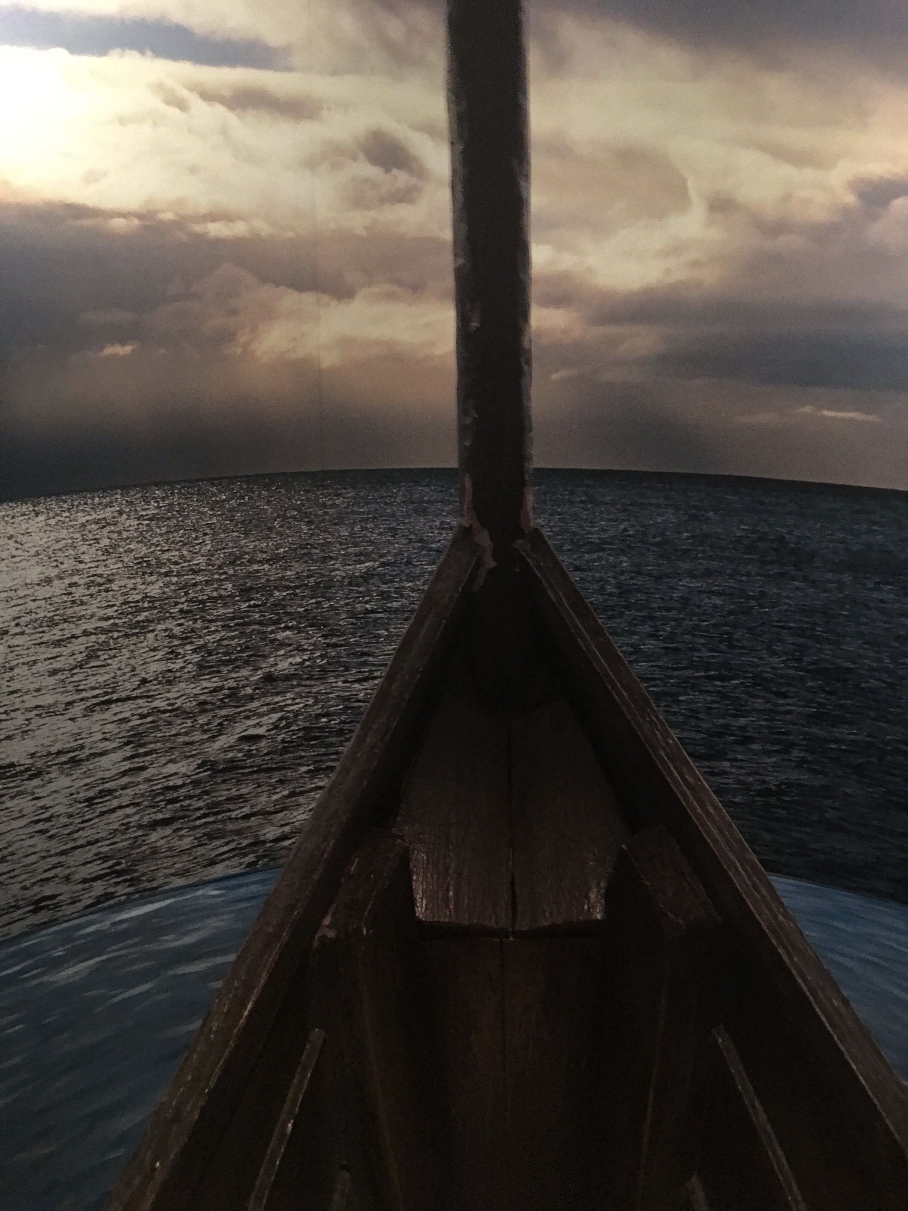
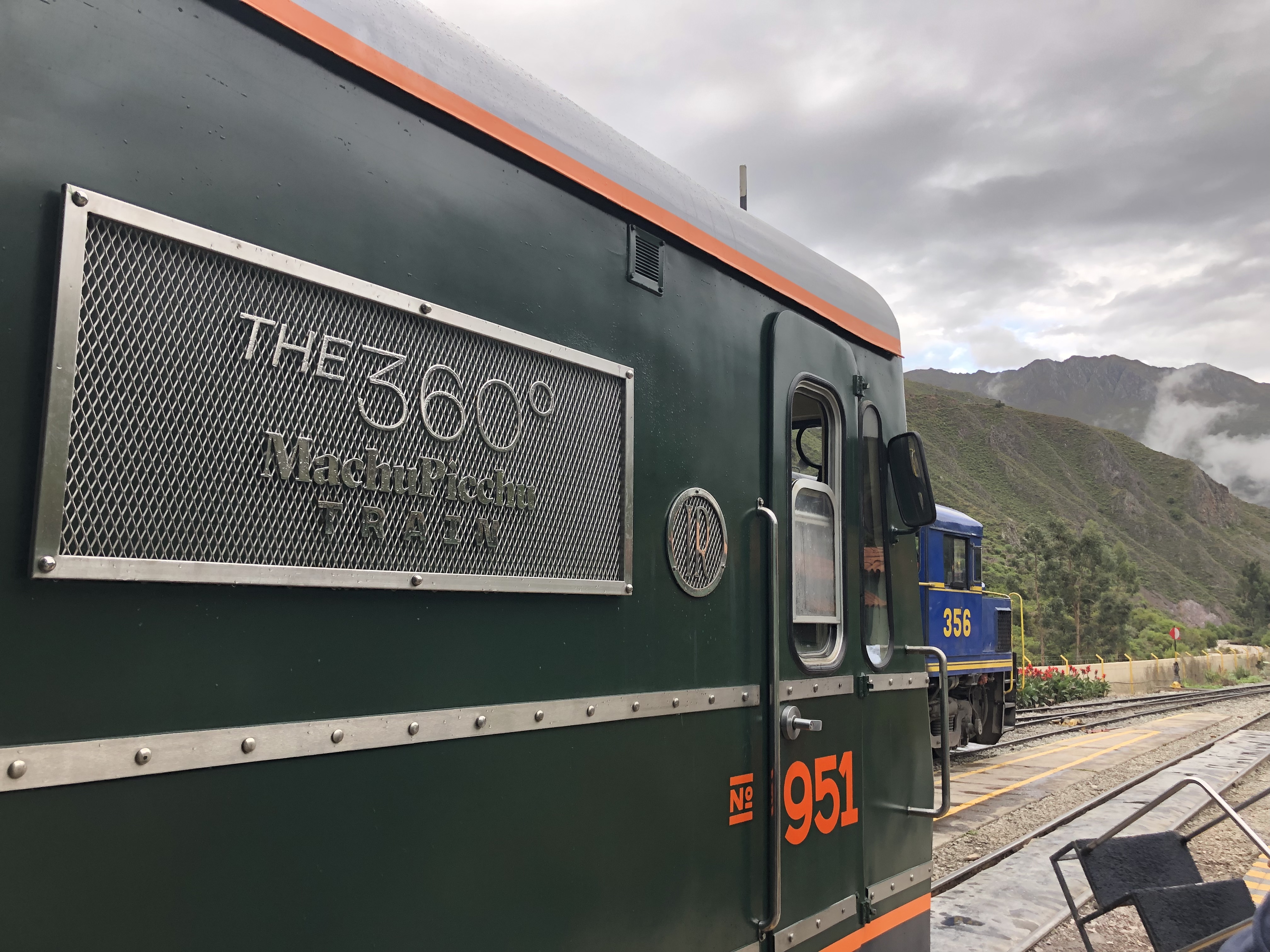
While we waited for our train, and after buying some breakfast, here is the waiting area for the 360 train on the Inca Rail.

img_2603

We boarded our 360 train and we were on our way.  The views were breathe-taking and beyond expectations.  There were outlets in every seat and four seats with a table in-between. Tons of room and we mingled with other tourists on the way to our grand destination.  We were anxious to enter the Amazon basin and the sights along the way.  What started as hills quickly turned to mountains all around us as we entered the Andes.  Chanel made friends with a couple girls sitting next to us that were traveling abroad, also from the USA.

The clouds seemed to follow us and yearned to join the expedition as they circled around the mountains, dipping into the plains en route to Peru’s crown jewel.

img_2620

About an hour into the journey, I kept seeing passengers head back to the observation car, which I had no clue was open-air.  I headed back a couple cars and understood what all the hype was about.  There is not a feeling quite like a train going full speed in the open air at the entrance to the Amazon basin with a raging river next to the tracks.  We had made it, this was the Peru and the expedition I envisioned.  I was transported back to July 24, 1911 when Hiram Bingham was guided by local farmers to the overgrown paradise we know today as Machu Picchu.  We were slowly getting sucked into the depths of the jungle, enveloped whole with concrete landscapes of Lima and Cusco, traded for lush, greenery in every direction.  I strained for any sort of activity, for any wild animals and ancient ruins.  I found both.

img_2651

The Inca people worshiped the mountains and the landscape.  They felt the weather was dictated by the mountains and the rivers and they gave them personification, with personalities that were deemed gods.  If there were not enough rains for crops, or too much, they felt they themselves were to blame for something they did wrong, they sacrificed to the mountains for redemption as the mountains were considered the most sacred of all.  The entirety of Machu Picchu is based on precise location in between mountains in every direction, a retreat for their king, just far enough away from the Incan capital of Cusco.  The city of Cusco itself is shaped like a puma, another sacred animal, as you can see below.  Their attention to detail of architecture and detail was unequaled.  Even the stones used to construct Machu Picchu were cut and inserted so tight, you cannot stick a piece of paper in between them.  To have done this in the 15th century without today’s technology or tools, is astounding.  Machu Picchu was supposedly built around 1450 A.D.

img_7285

If the train ride was anything of a precursor to grander sights, the bar could not be set high enough.  Machu Picchu is one of those places that no matter how many pictures you see or reviews you might read or stories you might hear, it will ALWAYS surpass your expectations.  There aren’t many places in the world that can live up to that.

Slowly, the train etched into Aguas Calientes, the small town at the base of Machu Picchu.  Machu Picchu is situated a hair under 8,000 feet, a good 3,000 feet LOWER than Cusco, if you can believe it.  We disembarked the train and immediately met up with our tour guide waiting for us just outside the train station entrance.  The guide had our tickets to ride the bus to the top of the mountain and he was easy to find with a yellow sign he was holding up.  There were two other people on our tour, so was a very intimate group, advantages of going in the off season.

The small town was built across a river with plenty of local vendors offering handmade goods that you could find in any Mexican or Latin American city.  Naturally, I had to take a picture of Toto’s house since it is my favorite band with my favorite song “Africa” and because I’m from Kansas.  I knew this was a sign I came to the right place, no better choice for my 40th birthday.

img_2660

The former name of the town was Aguas Calientes but it is now officially Machupicchu Pueblo.  So, if you see both names for the main town at the base of Machu Picchu, you know why.  You see the new name sign below across the entrance to the town.

img_2657

Our guide is featured below walking us through the city en route to the bus pick-up spot.  We are crossing the raging river that spits the city in two.  Our guide was super informative and was incredibly proud of his culture and heritage.  A husband and father of two, he spared no detail in pointing out the wonders that is Machu Picchu.  He answered every question as I had researched extensively prior to the trip about Hiram Bingham, the landscape and the construct itself.  A leader among guides.

img_2655

The bus ride to the top of Machu Picchu takes about 25 minutes.  It’s a standard greyhound-esque bus with continuous turns all the way to the top.  If you’ve driven the summit of Haleakala in Maui or any other mountaintop for that matter, you know the drill.  They are dirt roads with buses coming and going every 10-15 minutes.  The roads are narrow, so a little gut-wrenching going up and down as you peer over the rail-less edge to the ravine below.  I couldn’t imagine going up in the rain when the roads were muddy and slick.

Burt was navigator in the bus passenger seat and took video the whole ride up and talked with the driver, hopefully not too much to distract him from the steady turns, as you can see below.  🙂

img_2664

Once we reached the summit, we disembarked the bus and walked to the entrance of Machu Picchu, that is much like any theme park or major attraction.  There was a fairly long line of ticketed individuals swirling along roped-off entryways.  We waited a few people deep and went through the line.  Our tour was about to begin.

We walked a few minutes through the entrance and our guide took us directly to the most popular tourist spot for photos first.  The main entrance gate overlooking Machu Picchu from above.  This was the house of the Guardians.  This was the dwelling of those that took care of Machu Picchu.  If you were to take the 4-day hike from Cusco to Machu Picchu, you would see this view as you came down the trail.

I was under the impression I could easily walk over to the Sun Gate (entrance gate) to Machu Picchu on the Inca Trail, but I was wrong.  It would take half a day to reach the actual entrance gate on the trail.  It was high up on the mountain.  This entrance gate was specifically placed so that on the summer solstice, the sun’s rays would pass through the Sun Gate all the way to Machu Picchu and in through the window of the Temple of the Sun.  The attention to architecture and detail of the Inca was incredible.  If you are thinking this is very Indiana Jones-ish, there is a reason why.  George Lucas used this construct as inspiration when he created the scene of Indiana Jones in the map room of Raiders of the Lost Ark when the sun beams down and points the direction of the lost ark.  Indiana Jones was also inspired by Hiram Bingham, the professor at Yale and archaeologist/adventurer.

As you can see below, the Sun Gate is a tremendous distance from the Temple of the Sun located in the heart of Machu Picchu.  You can barely even make out the Temple of the Sun unless it was pointed out to you by a guide.  Staggering.

img_7287

img_7286

Another Sun Gate photo from the front.  All taken from online sources since I couldn’t make the hike there on our tour.

img_7288

Even though I couldn’t make the hike to the Sun Gate, the views overlooking Machu Picchu were more than any picture could give justice, as I mentioned before.  I can’t stress the enough.  The weather was a perfect 80 degrees and no rain whatsoever, in the middle of rainy season.  The Inca Trail was closed during the month of February for repairs, our guide told us mostly for bathroom maintenance, but they say due to rainy season.  He said due to climate change, it doesn’t rain in the Andes as much as it used to.

We couldn’t take enough photos overlooking Machu Picchu.  I had brought my Chiefs Kingdom flag in my backpack and pulled it out for a photo.  An adjacent guide yelled something my direction and then my own guide quickly told me to put it away.  Machu Picchu is such a sacred spot that taking a picture of any sort of sports team or anything other than a country’s flag is considered rude and disrespect.  I wouldn’t be able to take a picture with the flag overlooking Machu Picchu promoted Chiefs Kingdom. 😦

The mountain you see in the distance below has a trail up to the top as well, but they only allow 500 people per day and you have to book months in advance.  It’s called Huayna Picchu.  If we had a couple days, or more advance planning, I would have secured our spots on this trail overlooking Machu Picchu from the other direction.  I hear the climb is steep, but well worth it.

We, again, had made it.  This was it, a right of passage.  A Modern Wonder of the World.  A checkmark off the Bucket List and another expedition achieved.  No greater feeling than the feeling of adventure.

I’ll let the photos speak for themselves.

img_2671

img_2722

You see Alpaca’s everywhere.  They are considered a good omen for the local Peruvian people and culture.  I did eat one while in Aguas Calientes for lunch and later had an upset stomach and I’m sure the local gods were looking poorly down upon me.  Learned my lesson.  They have this animal on magnets, keychains and every tourist product you can imagine.  They are very friendly animals and super approachable.  I thought it a great thing they let them roam free across the ruins just as in the ancient days.

img_2733

The multitude of tiers below were for crops.  Each tier was a different crop the Inca would grow.

img_2728

After taking photos overlooking Machu Picchu, we started the trail down to the main gate of the ancient city.  I’ll describe in detail more of the depths of Machu Picchu in my next blog.  I’d be able to write for days on the details and staggering detail of the city, but I’ll try and condense as much as I can.  Until then, I’ll show a pic at the gate and hope you join me on the inside next time.

Stay hungry, stay curious.

img_2702

November in the Tropics

Time away doesn’t reflect my desire to write.  Sorry to (both…haha) of my blog followers as it’s been weeks/months since my last post.  I’ve actually started two other posts prior to this one that have yet to be completed, along with multiple new adventures along the way that have aided in sidetracking my updates.  It actually takes approx 2 hours per post when I include pictures, in the interest of time, I’m going to be inserting less pictures than I have in the past.  Hopefully, my words will be descriptive enough that I won’t need pictures and will encourage you to travel there yourselves.  (Wishful thinking).

Four years ago, while working at Jayhawk Sports Properties, I decided to migrate west to Maui for the 2015 Maui Invitational men’s basketball tournament.  I explored the depths of Oahu in the past, but never Maui.  Perfect opportunity to venture solo into the tropical depths of isolation and adventure.  It turned out to be one of the greatest experiences of my life with the Road to Hana, Blue Hawaiian helicopter tour, one men’s basketball game, luau for Thanksgiving dinner, condo on the beach, rented convertible and so much more.  Four years later, and I would relive some parts while venturing into new ones.  There are so many activities in Hawaii, it’s a job to even prioritize.

This trip would be different as my cousin John would be joining me as well.  Southwest Airlines have new flights from KC that can reach Maui, so I decided to build my Rapid Rewards Points and try them out.  There are no nonstop flights, so I had to connect in San Diego and then San Jose, before making my eventual destination at the Kahului Airport in Maui.  It was a long day of travel, but worth getting the points.  I never had to deplane in San Diego, so it was only a 40-minute layover on the same plane, en route to San Jose.  San Jose was recently voted one of the top airports in the US by Travel & Leisure magazine, so was anxious to check out that airport as well.   As it turned out, when we arrived in San Jose, they couldn’t get the gears working on the jetway that connects the plane to the gate, so that was 20 minutes extra of wait-time.  So first impression of San Jose was not spectacular.  The overall airport was “ok.”

Typically when you spend at least five hours over an ocean, you receive a larger plane.  This is not the case with the Southwest Airlines flights to Maui.  You receive the same 3-seat on each side, planes that you use domestically in the continental US.  This seemed a bit crammed for the 5-hour flight, but this could also be the reason the flights are cheaper, so make sure you set your expectations.  Possibly in the future, as Southwest grows more internationally, they will order larger planes for longer travel times.  We did receive a meal on the plane, however, and we did land an hour early into Maui, so I will gladly take speed over space, when you personally don’t receive more legroom anyway, just a bigger overall plane.  There are also no monitors like other larger planes, where you can watch movies and live TV.  You can download the Southwest app to watch on your own devices, but they supply no monitor for you.  We arrived so early into Kahului Airport that all the gates we already occupied.  We had to wait until a plane left to take over their gate.  So, we waited approx 20 minutes for that plane to leave.

My cousin had landed with United an hour before, so he was already waiting in the baggage claim area.  I met up with him and we were on our way to Enterprise to pickup our rental vehicle.  I selected a 2019 Chevy Camero convertible with 10k miles on it.  If you ever rent a vehicle on any Hawaiian island, make sure you rent a convertible.  Even if it’s a bit more expensive, you will have a thousand-times better experience, guaranteed.

It was mid-afternoon and the drive to our condo at Kaleialoha Condominiums was filled with sun, breeze and the reggae music.  The airport is located on the north-central portion of the island and the main hotels and condos are mostly located on the west coast in Lahaina and Kaanapali Beach.   The drive immediately runs south through the guts of the island to the southern tip and then you head west along the coast for another half hour.  The drive from the southern tip heading west fills you with gorgeous views of the ocean and adjacent islands, including Lanai and Molokai.  We’d later visit Lanai on a day-trip with a 45-minute ferry ride over with only two hotels inhabiting the island and nothing else.  Bill Gates rented out the whole island for his wedding day.  The isolation is paramount, but that skyrockets the prices.  Pancakes cost $30 to give you an idea.

I had stayed at the Kaleialoha Condos four years ago on the third-floor but this time I chose a corner unit on the second-floor closest to the beach walk.  The views from the balcony on all the oceanview rooms are unparalleled compared to any other view of any hotel I’ve stayed at in the world, and I’ve been to a lot.  The moon at night will shimmer along the water and beam light into your living room invited itself in unannounced, but always welcome.  I was always surprised how distinctly you can hear the waves this close to the water.  Most oceanview rooms at hotels, you can see the water, but you aren’t so close as to hear it at night as you sleep, like your partner you roll over to in the middle of the night.  The waves this close sound like you are a Seacaptain mounting the currents on a month-long journey in a prolonged storm and ecstatic for that  singular moment and wouldn’t have it any other way.

Our first order of business after dropping off our bags was food.  We unanimously agreed on fresh seafood.  I had been following Lahaina Fish Company on Instagram for a few years and always vowed to try them when I made my way back to Maui.  The restaurant was in the main “downtown” portion of Lahaina.  It’s a singular street with restaurants and shops and parking difficulties.  The server was superb and the view of the ocean with tiki-torches set the tropical tone of the trip.  I had the clam chowder, a cocktail and fish with linguine for my entree.    You could order anything on the menu and it would be incredible.  We each spent $75, so this would be the most expensive meal on the trip.  There is also Mama’s Fish House I went to four-years ago, but that was $100+ just for me, so we’d not be venturing there this trip, but I highly recommend it for those that have never been for their lone expensive evening out.  It’s located on the northern tip of the island, east of the airport, so it’s a ways away from the main Lahaina area, but worth it if you want a luxury experience.

The first full day in paradise brought the most adventurous and challenging.  I always like to schedule the most daring experiences towards the beginning of trips if I can, that way you can ease into the end of the trip and relax towards the end, and also be able to talk about your experiences with other people on the island or with your own party.  I had a morning rendezvous with Rappel Maui .  I’d drive 30 minutes to the meeting parking lot in the south and we’d take a single van to the dropoff site where our gear would be supplied.  My cousin John chose to do his own tour on Oahu to Pearl Harbor on the same day, so he left to the airport in an Uber to take a small plane to the next island.  I had already done Pearl Harbor years ago on Oahu, so I was ready to scaled some hills and waterfalls in the eastern part of the island off the Road to Hana.

I met up with Chris and Megan at 9a in the parking lot and they weighed me and we went over any history of injuries to  my shoulder or anywhere else.  Two other guys joined the tour, and it so happened they were from Overland Park as well!  They were not there for the KU games but were brothers living in two different cities on the west coast.  One lived in Seattle and one had just started working for Expedia.  The other lived in San Francisco.  The brother that worked for Expedia had two territories and they included Maui and Orlando, FL.  However, this was not a work trip, but he would need to make the journey to both locations twice per year to write about new activities to try, restaurants and travel tips.  What an awesome job that I was envious of.

None of us had ever rappelled before, but on the hour drive we talked mostly about cities we were from and what it was like living in Maui.  Megan was from Michigan and got up and left on a whim after college at Michigan State and lived with friends she met after she arrived.  Chris lived with his wife and two kids on the northern part of the island.  We drove halfway through the Road to Hana before we pulled off to the Garden of Eden where our gear would be.  I had my Go Pro camera that I would strap to my helmet and got some great footage of the experience.

We hiked 10 minutes over to the first dry wall where we’d rappel.  When we neared the site, you have two latches attached to your harness.  One latch must always be attached to the line they have screwed into the ground in the event you ever slip on the narrow walkways.  You must be connected to at least one line at all times.  When you get the point of transitioning to the line that goes down the side of the hill, you first latch on to that line, then unhook your original line on the top of the hill.

Megan was the first down the dry hill that went about 60 feet.  Chris stayed up top with the three of us and gave us a few pointers below:

  1. Always trust your equipment!  You must lean back fully and trust the line will hold you.
  2. Keep your balance.  Always keep your feet shoulder-width apart so your legs aren’t too far above you or below you as you walk down the side.  If they are too far above you, you will slap your bottom on the side and be staring upside down.  If they are too far below you, you will face plant into the rocks vertically.
  3. Your dominant arm is to NEVER let go of the rope.  This acts as your breaking system and goes behind your back.  The more you bring your arm to your side, the more slack it gives that allows you to walk down the hill.  The problem is, is that your arm gets tired halfway down the hill and you want to let go, all while trying to maintain balance while looking where to walk next.  NOT EASY!
  4. When we get to the waterfalls, never walk in the actual water, except for the beginning.  Always walk to the left of the waterfall and stay out of the current.  This is so challenging since you start out walking in the actual waterfall at the top and they slowly maneuver out of it the more you walk down, while it being super slippery.  They give you boots to wear with no tread on bottom, so makes it even more slick to walk.

There were all the pointers we were giving seconds  before we started as we stared down the hill.  We couldn’t even see Megan at the bottom waiting for us because the rockiness of the hill jetted out.  I was the last to go, thank god.

The first brother went down and fell flat against the rocky wall about 4 steps down into the rappel.  I was trying to learn what he did wrong to quickly apply my own technique to avoid what he did.

The second brother went down with no problems. He had walked down hills in Seattle, so he had a tad bit of experience, but he had done it in snow and not dry, but I would assume that was more intense.

With adrenaline coursing through my veins, I was the last to go.  In any touch situation, I have always learned to break each step down into fragments and it makes it more manageable.  I took one fundamental technique at a time and walked my way down the the hill.  I had a small slip towards the bottom, but overall, it was a perfect rappel.  We unhooked our harness from the line and attached to the new line at the bottom and were on to the next rappel….a waterfall.

We hiked a short distance and up a hill to the next rappel line.  We attached to the new line with water gushing down from a stream, turning into a raging waterfall.  It has rained the entire previous week, so the water level was high and consistent.  We were to start in the actual stream at the point it turned into the waterfall and gushed down the side.  My heart was racing, but I was excited to conquer it at the same time.  Again, I was glad I was last to go.

There were specific foot placements he told us about as we scaled down the first couple steps in the water down the side.  They were not easy to find since they were under water and not extremely close together.  Once we scaled down the side, the water emptied into a huge pond where Megan was waiting.  Once we reached 5 feet left in the rappel, we were to let go and fall backwards into the water.  An exhilarating feeling of accomplishment mentally and physically with an exclamation point at the end.

This was the hardest of the three rappel’s.  Between the flow of the water, the specific feet placements and the slow guiding to the side of the water as you walked down and the second rappel of my life, it was a lot to take in at once, but it only added to the adrenaline rush.  About five to ten steps into the rappel, I found my line wanting to guide me back into the flowing water that would push me harder down the side.  I stepped a few times into the water, managing not to allow the current to take me with it, while still holding on to the rope behind my back with my right arm.  It was taxing on my right arm and shoulder and I felt for sure that I would let go at some point.  But, I mentally would not allow it to happen, no matter the pain or fatigue.  I feel I have tears in my shoulder from many years of baseball, so it’s not in the most perfect condition to begin with, but this strain was intense, all while “giving” some slack on the rope only a little at a time to walk down the side.  Too much slack and your feet were over your head, too little and your feet were too far below you.  You needed just enough slack while avoiding the water while knowing where to step at the same time.

I managed to hold onto the rope with five feet left on the line to the water below.  I heard Megan yell for me to be ready to let go of the line and jump backwards into the water below.  With a feeling of major accomplishment and sweat, I free-fell the last five feet into the exhilarating water below.  The perfect ending to the most challenging rappel.

There would be one more rappel in a waterfall before we hiked back 20 minutes straight up-hill back to basecamp.  We’d have some lunch before driving back to the pickup spot where we started.  The perfect way to start the trip with some adventure and learning a new skill.

I’ll try to write more on this trip, finish my Iceland adventure last year and Peruvian adventure earlier this year in the coming weeks and months.  It is my goal to blog more of my travels in 2020 to inspire more and more people to be adventurous and to not get stuck in front of a TV at night, but to research new destinations that will help you grow, meet new people and thrive and to inspire others.  It’s so easy to subscribe to Netflix, Hulu, Amazon Prime and Disney+ and lose all sense of creativity and sense of self and adventure.  Don’t get me wrong, it’s fine to do that in moderation, but don’t make it a regularity so that it sucks the creative juices right out of you.  By always watching other people’s creativity, you begin to mimic their style and lose the style of your own.  The best ideas come in solitude, free from distraction and outside influence.  Like my English professor always said before every class, “Always turn off the TV and immerse yourself into a sea of reading.”


Entering the Sun Gate at 40-Machu Picchu

No one enters the Sun Gate and front door of Machu Picchu without it being on purpose.  Tucked in the interior of Peru, this Modern Wonder of the World is not easy to access on the eastern side of the Andes mountains and entrance to the Amazon rainforest.  In only having a few weeks to research and plan for the perfect 40-year-old gift to myself, this South American expedition seemed like the perfect fit in combining history, adventure, proximity and interest.  Two of my best friends, Burt and Chanel, would be joining me on this unforgettable trek deep into the interior of a continent none of us had visited.

Hiram Bingham was probably the only visitor to Machu Picchu to ever visit the site without meaning to.  The archaeologist that was also a lecturer from Yale accidentally discovered the site on July 24, 1911.  The site Hiram had studied for was supposed to be the Incan retreat HQ deeper in the Amazon jungle, now named Vilcabamba or Espiritu Pampa.  Hiram was interested in discovering this lost location because this ancient site was said to have hosted the Incas as the Spanish conquistadors were pillaging and occupying their empire in Cusco, and was rumored to be filled with gold and riches left for hundreds of years.  The Spanish were vastly outnumbered, but they had two key elements that turned the tide of war, horses and guns.

Local farmers in the region pointed Hiram in the direction of a mountaintop saying ruins of some kind had been taken over by vast vegetation and he may want to take a look.  This look would change the course of his life forever and currently brings 1.2 million visitors through the welcoming arms of the Peruvian Citadel every year.

Perfectly preserved, the ruins of Machu Picchu sat untouched for almost 500 years until Hiram arrived.  There was a supposed Inca civil war that broke out prior to the Spanish arrival and Machu Picchu was abandoned.  The Spanish conquistadors never found or knew about Machu Picchu, or possibly knew and didn’t care because they knew Cusco was the true “City of Gold” housing the riches they desired.  Regardless, this 8,000 foot high Citadel slept as the sun continued to blaze its rays every year at the solstice through its Sun Gate, beaming a perfect line straight into the belly of the Sun Temple.  Keep in mind, the Sun Gate is a two-hour hike on the Inca Trail high up on another mountaintop adjacent to Machu Picchu.  This would have taken immense engineering skills.

Here is the Sun Gate that marks the entrance to the Citadel of Machu Picchu for Inca Trail hikers.

machupicchu-sun-gate-1

The below picture shows you the staggering distance from the Sun Gate to the ruins of Machu Picchu straight ahead and the length of the beam of light the sun would offer.

25475014-view-from-the-sun-gate-on-machu-picchu-peru

Hiram III came from a long line of explorers in which Hiram himself was a part of the Royal Geographic Society.  The same society in which Isaac Newton was a part of and Percy Fawcett from the famous book and movie The Lost City of Z, also exploring the Amazon rainforest.  The Amazon jungle was the final unexplored surface area on Earth in the early 20th century, and now in the early 21st, I boarded a Delta flight to walk in those same footsteps.

But, before taking off from KCI, Burt and I needed to get a pic of our missing friend Nate that couldn’t join us on this journey.   (It’s a running joke with our group that we have to print out or find the most ridiculous picture we can find of the missing friend and take pictures of him along the journey with us.  This dates back to our baseball stadium trips we had taken).  So, we took our customary picture with Nate at the Royals Grill at the airport, and off we went.

img_2523

Burt and I were taking off from KCI and headed to our connecting flight in Atlanta at 12:20p.  The PA system goes on at the gate in KC announcing there was a plane issue upon landing of the plane we were about to board.  So, there was a delay of 15 minutes before we were able to board.  We had a 2-hour layover in Atlanta, so time was on our side.

img_8399

Upon landing in Atlanta, we grabbed a quick bite to eat at food court and were ready to board our night flight to Lima, Peru.  The flight to Lima was going to take just over 6 hours and was also in the Eastern Time Zone, so no jet lag.  We’d take off at 5:54p and arrive in Lima at 12:35a.  Chanel’s flight coming from Miami would arrive an hour before ours in which we’d meet her at the baggage claim.  We’d land on my actual 40th birthday.  The adventure began.

img_2527

The Delta flight was uneventful as I was continuing reading “Turn Right at Machu Picchu: Rediscovering the Lost City One Step at a Time” by Mark Adams that also followed in Hiram Bingham’s footsteps across the Andes and Sacred Valley in Peru.  It was fairly reassuring since this author was no professional hiker and gave a layperson’s account of the journey across all the major ruins that Hiram found.  We would not be getting this adventurous, but it’s a fantastic read and a NY Times Bestseller for those interested in learning more about the history and current day Machu Picchu.

You can find the book to purchase here, no pun intended, but on Amazon: https://www.amazon.com/Turn-Right-Machu-Picchu-Rediscovering/dp/0452297982

There was one side note on the flight, in which the light that burns above you as you read on night flights, I could not for the life of me figure out how to turn it off.  It had been left on by the previous passenger and I just kept it on reading for a majority of the flight, however, the one moment I wanted to turn it off to sleep and the stewardesses disappear, there was no “off” button or stewardess call button to ask how to turn it off.  So, I proceeded to jostle with the light, pound on it, twist it, nothing.  I pulled out my facemask I had brought to Iceland and was the lone seat with lighting the rest of the trip.  Fifteen minutes before we land, I finally see a stewardess and ask her how to turn it off.  She starts pushing buttons under my monitor on the monitor in front of me, nothing.  Then, she tells me to try going in the settings on the monitor on the monitor.  There, it finally is, in the settings section of my monitor.  How in he world would anyone have found that?  No directions anywhere.  Ahhhh technology.

Lima’s morning comes early.  Effects of the late hours were creeping up on us as we touched down at Jorge Chavez International Airport.   Both Burt and I did not check a bag so we hit the ground running to meet Chanel in the baggage claim area.  A tip I read on Peru transportation is to use Uber wherever you go.  The background check on Uber is at least minimal protection against scam artist taxi drivers in which taxi’s are not regulated by the country.  You are HOUNDED upon exiting the airport.  I had ordered the Uber while a taxi driver told me he’d charge me $1 less than my Uber.  They haggle you constantly and it’s one after the other.  We found our Uber parked in the lot across a few lanes from the departure area.

The first night in Lima I selected an Airbnb in the Barranco District.  This is an older cultural area of Lima, much like the Crossroads District of Kansas City.  There is a lot of art and older buildings and more a true, foreign downtown compared to its brother in Miraflores that is the high tourist area with JW Marriott’s and top retailers.  I wanted to immerse in both districts and we’d stay the final two nights in Miraflores in a condo overlooking the ocean to unwind.

After 45 minutes in the Uber, we arrived at the Airbnb and punched in the padlock numerical code and in we went.  The view inside the apartment was breathtaking.  We had the ocean to our right on the balcony and main city in front of us and to the left.  We had arrived.  We were injected with adrenaline and gained our second wind and were up until 4a in the morning.

img_2531

img_2536

The master suite:

img_2534img_2537

Hiram Bingham married into money in which his in-laws in NY gave their daughter and him $10,000 per year.  This was more than three times his salary at Yale and allowed him the freedom to explore the world and his passions.  Hiram was the inspiration behind the character Indiana Jones that George Lucas would later create.  You can see the similarities in Hiram being a lecturer at Yale, while Indiana was also a college professor.  You see the sun playing a significant role in the map room scene trying to find the Ark of the Covenant in the movie “Raiders of the Lost Ark” much like the sun’s rays beaming into Machu Picchu.

You can see the map room scene here as a reminder, one of the most impactful scenes of my early memory.  https://www.youtube.com/watch?v=gFDM7JGHGYo

Peru is sitting on the edges of the Nazca and South America tectonic plates and is an earthquake hotbed.  Another impressive feat of the Inca were creating structures and architecture that lasted hundreds of years through many earthquakes.  While Spanish buildings would topple, Inca ruins would remain underneath after the Spanish built on top of the Inca structures but never duplicating the fine architecture of the stone the Inca used.  You could not even fit a piece of paper in between the Inca stones and the edges were rounded to fit perfectly.  A mastery of their art.

So, it was no surprise that we wake up on my actual birthday later that morning at 8a to text messages and missed phone calls from Burt’s father-in-law Dave and wife Amber making sure we are all ok.  Overnight, there was a 7.5 magnitude earthquake at the Ecuador and Peruvian border.  We were fine since we were far south of the border as Lima is southern Peru, but we found it odd there was no news story on TV discussing the earthquake, it was that commonplace, but it was all over Fox News back in the states.

The sun brought with it incredible balcony views of the ocean we hadn’t seen the night before.  After months of freezing temps in KC, the warmth embraced us like a missing child while never promising to let go again.

img_2539

img_2540

We stored our luggage in the owner’s private storage room and we were off exploring this new, foreign summer-infested continent.

Lima is built up on a bluff with the ocean and highways down below.  We walked breathtaking views and watched as gliders took off near us with passengers inhaling views you dream about.  If this was how 40 was going to start off, I didn’t want to leave it.

img_2542

img_2543

We decided to take an impromptu photo, while Burt and I were prepared with sunglasses with the summer sun, Nelly had to purchase a pair once we arrived on the beach…..

img_2544

After strolling alongside the ocean we headed more inland to find an Uber to take us down to the beach and restaurants.  We passed some inspirational architecture and churches along the way.

img_2546

Of course as I walk into the church below and visit the extremely quiet nave where Christians are lighting candles, my cell phone starts blaring for all for God to hear.  It was my brother Paul calling to wish me a happy birthday.  I couldn’t imagine him having more typical timing as I run out of the church.

img_2547

Not long afterwards, we hail an Uber that takes us down to the beach.  We walk a ways to find sunglasses for Nelly and then head to a restaurant we see in the distance.

img_2552

We arrived early around 11a, but the restaurant did not open until 12n.  They had some benches were we relaxed for an hour before they opened and we inhaled the ocean breeze.

img_2556

img_2557

img_2554

The buffet and setting was staggering.  How we just landed upon this lunch paradise was pure luck as we had no idea where we were.  The views offered the perfect breeze.  The best birthday lunch I could ever remember.

img_2562

img_3138

img_2560

img_2558

We didn’t want to leave the setting.  We stuffed ourselves as much as humanly possible.  We found how cheap it is to eat and Uber in Peru.  I believe each person paid $30USD.  The Uber rides within the same district were $2-$5USD.  The currency in Peru is the Peruvian Sol.  The exchange rate approx 3:1.  We had exchanged some Peruvian Sols at the airport in Atlanta as we knew we’d need them for the ruins on the ATV tour in a couple days.

We’d then head from the restaurant back towards the Airbnb where we took a quick catnap out by the pool before our Uber took us to the airport.

img_2566

img_2567

We’d be headed back to Jorge Chavez International Airport en route to the Andes mountains and to an elevation of 11,0000 feet to the City of Gold…..Cusco.  Cusco had been the center of the Incan Empire and where many brave souls began their trek on the Inca Trail on a 4-day journey to Machu Picchu.  This hike is not for the faint of heart as the elevation will bite you and bite hard.  We all were taking Diamox, which are altitude sickness pills to help offset the effects.  You start taking them 2 days before entering the new elevation.  We were going from sea level to 11,000 feet in 1.5 hours of a plane ride.

In my next entry, I’ll break down the travel on Latam Airlines for the evening of my birthday, the domestic airline of South America that would take us to the City of Gold.  Our flight would depart at 6:16p, or so we planned.  There were disruptions I’ll explain in my next blog post, including a power outage at the airport, but what journey goes always according to plan?  God knows it didn’t for Hiram Bingham.  That’s where you make the greatest of memories and the grandest of discoveries.

Until next time…..


Endless Skies and Coastal Highs

The thing with being adventurous, is that you are never in one place long enough.  My time in Hofsos and with Johann and Steinunn was epically short, as were the views, the freshly inhaled air and the charm of the seemingly untouched land.  I’d vow to come back, and I will, at some point in my life.

There were a couple different options, according to the Rick Steves guide of Iceland, of how to get to the “Capital City of the North” that is called Akureyri.  Steinunn told me was pronounced “Awk-You-Rare-Ree” with a fidgeting of the tongue for local dialect.  However, for me, there was only one option.  The option I took was the longer route on Highway 76, venturing off the main Highway 1 (Ring Road), all around the Trollaskagi Peninsula coastline heading clockwise east.

The benefits of this route, were to first visit the town of Siglufjorour that used to be an old fishing town and boat-making town.  They would depart from this town and fish for 3 months over the summer June – August on tiny ships (by today’s standards).  There was one large museum that spanned 4 buildings I wanted to visit to learn more.  The drive to get to Siglufjorour was absolutely breathtaking and one of the best of the entire trip.

As I entered the town, I was awestruck on the endless blue skies with a small amount of clouds.  The bright colors of the buildings seemed to fit perfectly with the natural landscape.  The colors of red, yellow, light blue, all lined up at the edge of the ocean inlet in a valley.  You could imagine right way the ships docked in the inlet and the fishermen’s quarters adjacent to their ships in the harbor.  Present day fishing ships were lined here as well, but not to the extent of years past.

The museum was not hard to find as the bright red building that you paid and obtained your ticket was enormous and really stuck out.  There was a good size gravel parking lot adjacent to the building with the “Herring Museum” sign posted for all to see.

img_9230

The first red building housed the ticket office on the upper floor after taking some stairs up on the outside of the building in front.  The same floor was filled with model ships in glass cases and the history of the town and first settlers.  They had a log book filled with fishermen and ships that dated back to the 1920s.

The upstairs area was replicas of the fishermen’s quarters including their kitchen area, bunkers and so forth.  These were some small, tight quarters and there is no way someone of my height and weight could have lived in something so tiny.  They would fit 4 in a room and there were bunkbeds.

img_9247

img_9249

The lower part of the house opened like a huge garage and housed all the barrels and troughs they would store the fish when they arrived from sea.  It was a storage quarters for all the equipment they would use and spices used to preserve the fish.

img_9250

The second house was the salthouse where they stored all the spices to keep the fish fresh.  The third house was the factory where they prepared the fish and the final house was the shipbuilding house, which was my favorite by far.  They had sample ships you could walk on and see how truly small the fisherman’s quarters were inside the boat.  I could not get over how small and cramped of a boat they lived for 3 long, summer months.  The two pictures below are of the factory.

img_9261

img_9260

The final house was the shipbuilding house, and the pictures below don’t give it enough justice.  With large pictures and videos constantly rolling, you really went back in time to become one of these fisherman and actually climbing up into the boats and the cramped captain’s quarters in steering the ship.  I really don’t know how they did it.  The picture of the steering wheel was super cramped, I couldn’t barely turn around inside it.

img_9265

img_9275

img_9269

img_9271

The peninsula was very mountainous and I can see how it would be next to impossible to venture during the winter season.  Up in the mountains, the snow would cover most all the roads and make the trek most difficult.  There are long single-lane tunnels that ran through some of the mountains, and one of them was just outside the city of Siglufjorour.  After you leave the city, you curl around the inlet and back on the other side facing back towards the town, looking down upon it.  The tunnel is at the apex of the mountain on the other side of the inlet.  This video below is after I had curled around the inlet and was up above the city on the opposite side of the water and I was heading towards the entrance to the tunnel through the mountain.


As I approached the tunnel entrance, I was thrown off by the single lane.  I saw headlights in the distance, and with it being a single lane, I was freaking out to the extent I put my car in reverse and started backing out of the tunnel entrance I just came from, thinking I had missed a one-way sign somewhere.  It truly was something I had never experienced before.  The last tunnel I rode through on the way to Borgarnes (just north of Reykjavik) was two-lane and I figured all of Iceland was setup the same way.  I was wrong.  After noticing I had not missed any sign, I continued on and I eventually noticed there are “stopping areas” every 100 yards or so where vehicles can pull over and let oncoming cars pass.  This was going to be a fun game, I thought.  Trying to gauge the distance of the oncoming cars enough to sit and wait and guess if there was a “off road” to wait it out until they passed.  There definitely were more oncoming cars headed the direction I was coming from rather than behind me.  There were no cars behind me and there were 3-4 cars pulled over waiting for me to pass.  The thing about me going against the traffic, was there EVERYONE had to pull over at these stop areas that was oncoming.  So, those stop areas got filled up fast.  Most tourists take the Ring Road counterclockwise to start in the south first and work their way back up and around.  I took the advice of Rick Steves, as I had mentioned in one of my first posts and went against most of the traffic, which was a fantastic recommendation.  I found myself free of most traffic behind me and in front of me and to go more at my own pace.

The tunnel was enormous.  It was probably 7-8 miles long at least.  When I finally noticed light at the end, I did breathe a little sigh of relief as it does take some anxiety if you’ve never done anything like it in a foreign land.  You just aren’t sure of protocol and etiquette and Rick Steves did not touch on this in his guidebook.

As you exit the darkness, you are born again into the embracing arms of Iceland.  With the windows half drawn, I was able to breathe in the pure and cool air again.  There is something different about Iceland’s air.  I compare it to a taste of a cold bottled water compared to tap water.  It just tastes more pure, cool and natural.  That comparison can be made for the land, air and sea of this purified world.

The drive from Siglufjorour was breathtaking en route to my next destination town of Dalvik.  Dalvik was also known for their whale watching excursions, but I had little time as I was still planning on hitting a couple more towns en route to my final destination that day, which was a cottage overlooking the ocean in Husavik, the top whale watching town in all of Iceland.

The drive to Dalvik might have been the most scenic along the coastline.  With endless sunny and blue skies, I lucked out on the temperature and the sun.  I had read about a cafe in Dalvik called Gisli Eirkur Helgi Cafe.  It was an all-you-can-eat lunch and it was decorated like an old ship bar on the inside.  It just had so much character and brought you back in time.  The lunch was extremely expensive at $17 for lunch, but the owners of the house/care were making the soup fresh in the kitchen in the back.  They couldn’t have been nicer people.  The link to the cafe is here, they only have a Facebook page: https://www.facebook.com/bakkabraedurkaffi/

img_9291

img_9294

After grabbing my fresh, warm soup and salad and bread, I headed out on the front patio since it was such a perfect day outside.  The views with the mountains in the background were spectacular.  The cool temps combined with the hot soup made for the perfect lunch spot.  I had planned this well, this was Iceland.  As you can see below, they had antique dishes and coffee cups.

img_9295

img_9297

After eating a quick, scenic and delicious lunch in Dalvik, I was on my way to the “Capital city of the North” for which they called Akureyri.  I took Highway 82 back to Highway 1 (Ring Road).  The Ring Road does not go around the peninsula, but rather cuts across inland for a faster route.  I wanted the experience of the museum and the coastline drive and Dalvik, so I took Highway 82 that added a couple hours to my drive, but was so very worth it in every way.  I was not in a hurry and factored it into my planning for the day.

The drive to Akureyri was one of the best drives of the entire trip:

After a few more hours of breathtaking sights, I arrived in the second-most populated city in all of Iceland, Akureyri.  There are daily flights from Reykjavik to Akureyri, but for those people, I hope they have made the drive many times, because they are missing out on a whole heck of a lot.

The town is a port town with cruise ships that have encircled the country.  It’s located in the northeastern part of Iceland, about 4 hours and 45 min drive from Reykjavik if you went straight through and avoided the peninsula and went more inland.

I parked downtown and started to explore.  I only knew about a bookstore I wanted to check out, and a local church that overlooked the town, but other than that, I didn’t know much of what I wanted to see.  The town had only a couple major retail areas, but you could tell it was a port town with huge cruise ships docked nearby right next to the water.  There are a lot of souvenir shops and clothing shops.  I found the local retailer 66 degrees north, in which their apparel is super quality, but very expensive, much like Patagonia or The North Face in the USA.

You can find their products here:  https://www.66north.com/us/?redirect=true

Here are some downtown shots, the architecture was amazing:

img_9301

img_9302

The bookstore I was searching for is on the right-hand side of this picture.  This is the main bookstore of Iceland and is in many towns across the country.

img_9313

You can see they are so very proud of their fantasy heritage and folklore with trolls, fairies, dragons and fantasy.  The love storytelling, which I loved.

img_9307

Here is the church that overlooked the town:

img_9314

img_9331


And the inside was just as mesmerizing, the glass told stories of the early church:

img_9320

img_9319

And the look back down over the town, and you can see the cruise ships straight in the distance to the right with the port a major part of the town.  The town square is off to the left:

img_9318

Just as I was exiting the church, I found a guest book and entered my name.  I was a part of Rockhurst High School’s Kairos retreat my senior year and we were the 11th class.  So, I wrote an inscription only those that have partaken in Kairos would understand “Live the Fourth!”  To see all the signatures from people all over the world was a testament to the melting pot that is Iceland:

img_9328

Spending the day in Akureyri was more back to reality.  It was a little surreal to be in such rural areas the whole day with the drive and then land in bustling city in the middle of it all.  I wasn’t a fan of the city all of a sudden and craved the adventure of the open road again and more of the isolation of the rest of the land.  I wanted to explore the waterfalls, the caves, the mountains and the sea.  After a few hours, I was back on the road again.

Much like Siglufjorour, you drove around the inlet of Akureyri and then up the mountain on the other side of the inlet, looking back down over the city.  I’ll end this blog with the pictures and video below looking back down towards Akureyri, where you could sit in puzzled nature as to how this foreign land was a secret for way too long.

img_9336

img_9337

img_9339

Until next time….on the road to Husavik and the cottage overlooking the sea…..

Isolated Arctic Paradise

Just below the Arctic Circle, there lies the northern tip of Iceland.  The land is less populated than the south, but many more sunny days take refuge and is as lush as the countryside in Ireland.  Small town values and morals rule the region as inhabitants live off the land and take pride in fishing for Cod for dinner and raising horses and vegetation.

I drove from Kolugljúfur Canyon towards the Airbnb in Sauoarkrokur, which is at the base of a northern peninsula.  The Airbnb was owned by the friendliest couple I would come to meet in all of Iceland.  One of my initial goals of driving around the entire country and staying at locals houses was to immerse myself in the culture and soak up as much knowledge and information as I could.  I had been majorly disappointed at my first Airbnb in Reykjavik since my main host had gone on vacation without notifying me ahead of time.  I might as well have stayed at a hotel (granted paying a ton more, but would have been worth it for the room size).

There was no address for this couple, whose names are Steinunn and Johann.  Not only did they turn out to be the most pleasant couple, but they were the most communicative via email prior to embarking on my journey.  They offered to set me up with horse rental, as they own several right there on their property.  They offered me 4 different sites that are off-the-beaten path to visit and are not in main travel books, two of which I visited prior to their house (the rock formation in the water Hvitserkur and the waterfall in the canyon Kolugljufur).

Because they had no address, they gave me latitude and longitude coordinates that equated to be 65º 43′ 49.265″N and 19º 31′ 41.687″W.  If this doesn’t light your adventure fire while traveling solo in a foreign country by vehicle, nothing will.  This was right down my alley.  But, I had to learn before the trip how to insert the “degree” symbol into Google Maps and figure out how to use this type of navigation.  It turns out it was super simple, all you have to do is hold down the “0” button and the degree symbol will appear on the keyboard.  You can type in the coordinates as I wrote them above, and it will take you right there!

It took me 1 hour and 17 minutes to drive from the canyon to the Airbnb.  I arrived at 7p local time and was pretty famished.  The actual house was just east and south beyond the city of Sauorkrokur about 10 minutes.  The drive into the town was immensely breathtaking.  The ocean with mountains all around and flat land was something out of a fairy tale.  There is a movie theater playing current movies, which seemed out of place in such a foreign and rural land.

The GPS directed me off the main road once out of town and onto a gravel road, but was only on it for half a mile before I approached the ranch on the right-hand side of the road.  The ocean emptied right into the house’s backyard and would offer a glorious sunset just after midnight that night.  My first view was the pic below and Johann was outside working on his trailer.  They were going on an excursion horseback tour in a couple days and they were going to be camping out.

img_9218

There were horse pens on the right and left of the house and as soon as I drove down the gravel drive, the horses all ran over to greet me from the left.

After making introductions with Johann, Steinunn was also there hard at work in the kitchen.  The aroma smacked me in the face as I wasn’t expecting a home-cooked meal, but that’s just how the locals in Iceland operate.  They are super kind, always eager to help out the traveler and aid in any way they can.

Once introductions were completed, they showed me to my room.  I had a gorgeous view of the ocean dumping into the inlet of their backyard.

img_9157

Their living room was quaint, filled with knick-knacks and furniture, but very simple.  There was a separate room off of my bedroom closed by a curtain that could act as another bedroom if there was a family staying with them that needed a couple more beds for the kids.

The main living room and kitchen is below:

img_9211

img_9209

Even though I could smell the home cooked meal brewing in the kitchen, I knew I had limited time in the area to explore one of the most supposed and unique structure in all of Icleand, which was the geo-thermal infinity pool in Hofsos and they call it Infinity Blue.  This was a 30-minute drive east and then north up along the peninsula, but the pictures online and in travel books was something I could not miss.

When I mentioned this infinity pool to Steinunn, she seemed a little disappointed I wasn’t staying for dinner, but she absolutely understood.  She never voiced the disappointment at all.  She immediately called the pool and made sure it was still open and she confirmed it was open until 9p local time.  It was approaching 7:30p, so by the time I got there, I’d have a good hour to take it all in before it closed.

I didn’t have much time, so I said my quick goodbyes and was off to Infinity Blue.  The 30-minute drive was spectacular.  The drives in the north were my favorite drives of the entire trip.  I’m not sure why tourist books love the south so much, as I was a much bigger fan of the north.  A partial video is below:

Once I arrived at the Infinity Blue, I could not stop taking pictures with my Nikon, camera phone and Go Pro.  There was a blue-roofed church painted white all around the sides across the street that you would figure to see in an Iceland calendar.

img_9179

I parked in the gravel lot and the pool was off to my right, the church behind me and the bluff overlooking the ocean directly in front.  This was my favorite view of the entire 8-day journey.  The town was also my favorite.  This pool was planned beautifully and perfectly and built into the landscape with such exactness that I no one could imagine it not being there.

Below is a video of my first encounter of the pool before I went in.  There is a trail that leads down directly in front of me so you can get closer to the ocean and view the sunsets.

Upon entering the clubhouse, you pay a reasonable $12 fee for one of the most glorious views of your life.  You then must change and shower, as is law in Iceland prior to jumping in a public geo-thermal pool.

The site is located here: http://infinityblue.is/en/front-page/

I didn’t take my camera out to the actual pool since I didn’t have my waterproof case with me, but I did bring my waterproof Go Pro and got some great footage, but I haven’t loaded it to my laptop yet.  So, the pictures below will have to do for now, still spectacular.

img_9176

img_9174

img_9177

There were a handful of people in the pool, but definitely not crowded.  The water held people that spoke languages from all across the globe, a true melting pot of culture.  It was in the upper 40s in temps as the sun was setting to the east on the right-hand side of the pool.  I laid my arms up over the outside of the pool, took a deep breathe, and relaxed for what seemed like the first time in 4 days.

After the flight and the driving and the tour and everything I had encountered, this seemed like the first time I could catch my breathe and enjoy the fruits of my restless and determined days in guiding me to this exact spot and to take in this exact moment.  I turned off my Go Pro camera, set it outside the pool, and inhaled and observed life for 30 minutes.  It was the greatest 30 minutes of the entire trip and I’ll never forget it to my dying days.

img_9175img_9170img_9169

It was approaching 9p and closing time, so I jumped out of the water water into the freezing 40 degree temps and ran straight into the shower room, got dressed and was trying to figure out a close restaurant.

I found a great spot just right down the street in what looked like a regular blue house but is called Restaurant Solvik.   Solvik means a school where people come from all sorts of backgrounds to study.  I couldn’t think of a more fitting name.

They were getting ready to close, but agreed to still serve me.  There were picnic tables and benches on the patio out front and I wanted to watch the sunset as I ate.

img_9184img_9196img_9186

I ordered the Cod soup and the lamb for dinner, in which lamb is huge in Iceland and I had not tried it yet.  It also is not cheap at $57 just for the lamb.

img_9192img_9194

I must say, the lamb was not worthy of the hefty $57 price tag, with a lot of the meat being fat.  The Cod soup, however, was incredible.  But, I would have paid that just for the atmosphere and the view.  The temps were dropping pretty steadily and I was in the shade, so it was definitely getting cold, but was worth it all.  I had my “KC World Series Champs” stocking cap with me, so I was prepared.

After the feast, I stuck around a bit and sat on the hood of my car and, again, took in the sunset as the time approached 10p.  It was still just over 2 hours from the sun actually setting, but the reflection off the water was still worth it.

The drive back to the Airbnb was relaxing since I wasn’t rushing back like I had been on the way there and the sunset in the distance offering a tranquil feeling.  It had been a long day and I was absolutely going to crash when I got back.  I knew I had a long day coming the following day of driving around the coast of the northern Trollaskagi Peninsula on my way through some great cities Siglufjorour (Herring Era Museum), Dalvik, Akureyri (considered capital of the north and Iceland’s second-largest city), and finally staying in a cottage overlooking the ocean at Husavik (huge whale-watching town).

When I got back to the Airbnb, I took some photos of the backyard as the sunset.  I had wanted to stay and blog here, but I was just way too tired.

img_9155img_9158

The morning came early on day 5, July 18, 2018.  I was sluggish but the adrenaline was starting to race for the day’s excursion.

I hopped in the shower, which was a nice change of pace since it was my first actual stand-up shower in Iceland.  Johann was already in the kitchen with food laid out for me.  Again, so hospitable and so accommodating, I really felt bad I didn’t get a chance to sit and talk to them more.

As I ate breakfast, which entailed a turkey sandwich and toast, he asked me about America as they both had never been.  They knew of our sports basketball and soccer, but knew nothing of baseball.  Steinunn asked if that was the game with the bat and took a stance.  I laughed and told her she was correct.  They were both teachers, which allowed them both summers off work.  So, that is why they opened up their house for Airbnb and they love having travelers from all over the globe.  They left their homeland of Iceland to live in Switzerland for 10 months before their son encouraged them to come back home.  They loved it over there, but they both agree Iceland is more beautiful.

Johann is a music teacher and used to be in a band that traveled all over Iceland, but he quit about 2 years ago.  Steinunn is a Kindergarten teacher with a gentle heart.  They told me soccer and basketball are the two major sports in Iceland and told me how proud their country was for making the World Cup in soccer for only having 350k people that live in the country.  I told them soccer is not huge in America, which is why we did not qualify for the World Cup, which was embarrassing.  Johann mentioned they only go out to eat on special occasions such as birthdays and anniversaries.  They live off the land and catch Cod to eat for dinner most every night.  They like to plant vegetables, but they were in the midst of the wettest summer in 100 years in Iceland and it pretty much destroyed all those crops.  I asked him how hard it was to have all the sunlight in summer, but then only a few hours a day of light in winter.  He said the worst part is how wet it’s been, it doesn’t even feel like summer and then goes straight into winter.  They never get used to dark-filled days of winter.  I could not imagine that.

I promised to keep in touch    They asked me to sign their guestbook and I did.  In return, I asked to take a selfie with them both and they are below.  They were the nicest people I met in Iceland and I hope we can cross paths again.  I told them my mom and stepdad were coming next month, but I doubted they ventured this far to the interior of Iceland.  They gave me their card anyway.  Maybe on my next trip out there, I can stop by and say hello.  I also met their son for a quick moment the night before when I got home.

img_9217

Before I left their driveway, I had to take one final video of the morning sun.  It was about 8a-9a and the horses were up and moving about.  I wished I could have stayed another night there.  Great life moment.

I took up a lot of time on this specific blog because this was my favorite part of the entire trip and I wanted to document it in a way that encompassed all the details, from the sights to Johann and Steinunn to everything in between.  I had been so rushed through the trip to this point, I was the perfect breather and combination of relaxation and adventure that was due.

My next blog will focus more on the coastal drive and towns reached on my way eventually to Husavik, which was the nicest actual place I stayed on the trip in the cottage overlooking the ocean.  It would be the only time in the entire trip I had a bathroom to myself.  I really wish I had many more days in  Husavik as well.

Until the next adventure……

Untouched By Man – A New World

Sometimes when you need relief from stress, from work, from bills, from life, you go to the gym.  You go towards your own personal hobby.  You journey to the one slice of this planet that is yours and yours alone.  Something that sets your soul at ease.  Something you can control and peels the orange of life from distraction.  Highway 1, the Ring Road that encircles Iceland, is the crown jewel escape that is applicable to us all.  No matter your hobby, no matter your workout regimen, no matter your bank account, Highway 1 will deliver the fruit, our common denominator, and take you back home.

Outside the city lights of Reykjavik, just an hour north, you begin to grasp the primitive, preserved and powerful aesthetic of Iceland.  In all its natural glory and God’s original plan, a chance to partake in originality of man and Earth.  Just as a child, a chance to discover this world all over again.  A second chance.  A do-over.

I was bound with excitement as I left Reykjavik, with anticipation pouring out of my bones.  A new day, a new adventure.  This would be the first day of 5 in which I’d be journeying into Iceland’s countryside, dissecting what made it tick and the clock-workers that greased the gears of the land.

I had purchased an Akaso mountable 4k camera the previous year when I visited Sonoma in Arizona and went offroading on an ATV.  I brought this same camera with me and planned to mount it on the dashboard of my rental car and turn it on with scenery that my eyes could not contain alone.  I had 3 hours and 2 batteries of potential footage to utilize.  So, I stuck the mount to the dash, setup the camera, and I was out of Reykjavik in 20 minutes.  Here is the very affordable camera I purchased on Amazon.  It comes with a wrist strap that allows you to start and stop recording so you don’t have to hit the device itself and also a waterproof case and tons of mounts.

https://www.amazon.com/AKASO-EK7000-Sports-Waterproof-Camcorder/dp/B01HGM33HG/ref=sr_1_4?ie=UTF8&qid=1534383453&sr=8-4&keywords=akaso&dpID=51CozYtotxL&preST=_SY300_QL70_&dpSrc=srch

There are a few roundabouts as you head north out of town.  Most tourists and sightseers start by driving the south.  After reading Rick Steve’s book on Iceland, he recommended taking in the sights in the north first and driving clockwise around the island nation as you build up to the greater sights along the way in the south.  I chose that path to go against the normal tourist.  Most sights in the south are only a few hours away from Reykjavik, so many tour buses will offer day trips to waterfalls and back.  I wanted to go against that traffic going west from east on the tail-end of the trip rather than start that way behind those very same buses in the same direction.

My first destination was Borgarnes.  It is an hour north of Reykjavik and I was planning on stocking up at the local Bonus store for lunch and snacks as I ventured into the vast countryside of Iceland where there is not many stores along the route.

The drive up to Borgarnes was a wonderful Forward if it was a written version of Iceland.  The marshes off the road to the left and the mountainous peak and valleys to the right echoed the pictures I’d seen of the route.  In the most northwestern areas, there are fjords, but I would not venture that far northwest.

There is a tunnel a few miles long, and upon exit, you pay 1000 krona, the equivalent of $10 in the USA.  Probably the most expensive tunnel I’ve paid for, but the only tunnel in the country that you have to pay.  I was glad I exchanged currency at the airport of $100 to krona, but I knew this would be coming after reading Rick Steve’s.  The toll-taker was a beautiful Icelandic  blonde woman,  the kind you would think worked a toll booth in Iceland.  Any job that pays is a great job in Iceland.  As you can see in the picture below, the water marshes are a popular sight along the coasts.

img_9104

After the quick hour drive, I was headed to the Settlement Center in Borgarnes.  This Settlement Center doubles as a museum and a restaurant.  There is a 30-minute audio tour that Rick Steve’s recommended for most any language you speak.  It goes over the history of how Iceland was settled by the early Nordic Vikings and how advanced they were in shipbuilding.  So, I had plugged this destination into my Google Maps.

The town itself is smaller than Lawrence, Kansas.  It’s more a township with a couple gas stations, Bonus store, suburb with neighborhoods.  I parked adjacent to the Settlement Center in a circled lot next to a playground.  Directly next to my car was a bay with a bridge I took a pic of below.

img_9056

Off to my left and across the street, I noticed the perfect location to take my photos and a gravel path.  I decided to venture down and explore before I visited the Settlement Center that had just opened at 10a.

img_9058

img_9060

With the views above, I figured if this journey was going to be anything like the first hour’s views, I was in for the time of my life, and boy, was I right.  Not many get a chance to view these initial views alone, especially from the Midwest.

The Settlement Center was like how you’d expect, a few warehouses banded together with a barn-like door at the entrance.  It took me a few minutes to figure out how to enter, but ended up following a few people arriving before me.

In the picture below, the entrance is the green barn door on the right in-between the other main buildings.  The restaurant is on the far left.  The actual audio tour is the building on the right.

img_9066

Once inside, you immediately are struck with souvenirs.  The lobby doubles as a souvenir shop with all sorts of Icelandic trinkets and a few workers speaking Icelandic and English.  There are a collection of headsets to the left of the front desk and you can tune any headset to any language by adjusting a dial on the site of the ear piece.  The picture below denotes the main lobby with the front desk and entrance to the self-guided tour on the right.

img_9068

Once you pay and receive your headset, you walk up the stairs and into the tour.  The exhibits are marked by numbers that will correspond with the number explained on your headset.  You are not allowed to take pictures on the audio tour, but I snuck in a photo while aboard a mechanical Nordic Viking vessel as it demonstrated the rockiness of the waves as the Vikings searched for new land.  It was very well done and I figured if I could help them tell the story of the Settlement Center, why not not a picture?

The front part of the boat you step on below rocked in a circular motion back and forth and around, just as a ship in heavy waves.  There was a panoramic picture of the sea that went around you so you could pretend you were venturing to a New World.

img_9071

There was also a map with electronic lights that would light up when you pushed other buttons on the side on which areas were settled in Iceland, at what time period, and by whom.  I was surprised that most descendants were still living there with privately owned farms.  Not much has changed since the early settler times.  You can witness on this huge map, the routes of the water runoff that were naturally created to allow the ice to form their own roads to the sea.

After 30 minutes, I left the Settlement Center, checked the escalated prices of the restaurant, as I was starving as it approached lunchtime.  I didn’t want to pay the high prices of $30+ for a meal, so I checked Google Maps for a local coffee shop.  Thankfully, there was one right around the corner to the left.

As I drove around the corner and parked, there were 4 women working on installing new pavement on the sidewalk.  I found this rather odd in that you don’t usually see a group of young women installing new pavement on a sidewalk in the USA.  They had their stereo blasting to techno music, that is very popular in Iceland.  Getting a little taste of the local culture.

The outside of the coffee shop didn’t look like much.  But, the inside was more decorated than most any other coffee shop I’d ever been in.  The rooms just kept coming and it was very spacious with a huge patio out back with a fence and mountainous view.  The shop that I visited has this website: http://blomasetrid.is/

img_9074

img_9079

img_9076

I could have read and drank coffee on this back porch for days and it was a beautifully sunny day when I was there.  It turned out the north was much better weather than the south as the south is the wettest part of the country.

There were a few people in different areas of the coffee shop, but I couldn’t find a worker or a menu.  So, I figured, I’d go sit near the front desk and wait for them to notice me.  I sat at the front table near the window for 10 minutes, and no one approached me.  Awkward.  I even later realized the owner was sitting talking at the table next to mine that is featured in the website with his dog.  So, with my stomach growling angrily, I was on operation breakfast and find someone that worked there.  As I approached a young women in the back near the kitchen, I asked to see a menu.  She immediately started apologizing as she said I looked so content that she thought I had already been helped.  Go figure.

So, I ordered a Belgium waffle and a coffee.  They needed to heat up the equipment, so it took about 15 minutes to make.  But, man, was it one of the best waffles I’ve had in my life.  Worth the wait.

img_9085

img_9081

I struck up conversation with the front desk worker who was sitting behind the desk on the left in the picture above, her face partially hidden by the fake trees.  She mentioned this was a bed and breakfast as well and gave me their business card.

I noticed  a guest book sitting on the front desk and I asked to sign it in hopes my mom coming to Iceland next month would find it, it would give her something to look for like a scavenger hunt.  I thought that would be pretty cool in such a foreign land.

Low and behold, a month later, my mom visited the same coffee shop and found my note.  The note and picture of her are below (as I write this many weeks after my journey).

img_0006

img_0007

I’ll never forget doing that and she mentions she wrote me one back in the same book so that it will inspire me to head back to Borgarnes one day.  We share the love of adventure, traveling and learning.

After leaving the amazing coffee shop that I wanted to stay at forever, I needed to stock up on snacks.  I visited the local Bonus store and bought some Gatorade, peanuts, Pringles, 12 inch sandwich, Ritz crackers.  The store is more a warehouse with food on pallets you pluck out on shelves like Sam’s Club.  You can tell everything is imported.

Upon leaving the Bonus store, I visited my first gas station in Iceland.  In order to pump gas you select your increments in krona.  So, I soon figured out after trial and error that 2000 krona filled a quarter tank of my Toyota Yaris.  So, that’s $20 for a quarter tank, equaling over $4 per gallon.  Gas is expensive.  You also need to know your pin number whether it be a debit or credit card to pay for gas.  It will ask you regardless.

After filling up  my tank, I was off and headed to the Grabrok Crater.  This crater was about 35 minutes north of Borgarnes.  Of the 3 craters formerly next to each other, this was the only one left fully intact.  There are steps that lead all the way up and around the tip of the crater offering tremendous views from above.

This was quite a tourist spot as there were many day-trippers there with cameras around their necks.  I was still close enough to Reykjavik that there were still a good handful of tourists.  The photo below replicates a stairway to heaven as you “climb” the crater.

img_9091

img_9093

It really doesn’t take long to climb and encircle the crater.  You can do the whole thing in about 30 minutes, but I took a ton of pictures both on my phone and on my Nikon D5100.  Looking back inside the crater is the photo below.  The path I had just taken is on the left.

img_9095

There was an adjacent crater in the picture below to the right as I was standing on the top of the other crater.

img_9099

The views were spectacular, and again, I was pinching myself I wasn’t even a full day into my journey into the interior.

The local residents of Iceland are extremely helpful.  Tourism is so new to them, they want to share their culture and appreciate the money it brings to their growing and developing country.  The local Airbnb residents I was staying with that night, Johann and Steinunn.  They were instrumental in giving me coordinates to some unexplored areas not in tourist books or maps.

One of them was a rock formation in the sea that I wanted to visit.  This reminded me of the movie Goonies when Mikey finds the rock formation that fits in with his rocky trinket he’s carrying around that Chester Copperpot had used to try and find One-Eyed Willy.  I needed to find this rock.

The rock formation is called Hvitserker in the northern countryside.  I had to travel for over 40 minutes on gravel road until I got there in the middle of nowhere, and I loved every second of it.  The landscape of the country was so gorgeous, I had the ocean to my right and country road in front of me and countryside to my left.  For many moments, I had countryside all around me with green, lush fields.  The water was so blue and the air was so fresh, I can still taste it.  The picture below was on a short path heading towards the bluff that overlooked the rock formation down below just off the beach.  I include a video below the picture as well.

img_9110

The bluff overlooking the rock formation is breathtaking because you can see ocean all around you and then a brown beach.  As you can see below, you are quite a ways up overlooking it all.  The landscape is such that it’s very steep to get down to the actual beach.  I went back and forth on doing it for 30 minutes.

img_9111

img_9113

As you can see in the picture above, some of the formation is covered in white excrement.  This is part of where it gets its name.  The word “Hvit” means “white” in Icelandic and “Serker” means long shirt.  So, it’s basically a white long sleeved shirt.  All rock formations have legends behind them.  The legend for this one is that the rock formation was a troll from Strandir in the western fjords and couldn’t stand the Christian bells coming from the convent in Þingeyraklaustur.  So, as he was on his way to tear them down, sunlight approached instead, and turned the troll into stone for all eternity.

img_9115

The steepness of the landscape is below and I don’t think it does it justice.  I decided to give it a go and it was the best decision.

img_9117

I decided to give it a go and it was the best decision.

I couldn’t take enough pictures of the beach, the water and the formation.  As you can see in the video, there was a fair amount of tourists there, more than I expected based on vehicle traffic as there was barely any.

img_9127

I had to touch the water to see how cold it was, but it wasn’t as cold as I would have thought.  I took plenty of pictures on my Nikon and some I will cherish forever down on the beach.  Definitely was more enjoyable that I ever thought it would be.

My next “off the grid” recommendation from my Airbnb hosts was a waterfall on the interior of the countryside.  This was going to be even more of an adventure and less touristy than the rock formation.  I would venture into even more isolated areas than what I traveled before the farther I got from Reykjavik.  This was all heading in the direction of Sauðárkrókur where I was staying in the countryside.  There were hotels, but I wanted to avoid hotels at all costs and stay with the locals and immerse myself in the culture.  They only gave me latitude and longitude coordinates as they didn’t have an actual home address.  I learned how to use the degree symbol on Google Maps.

The waterfall I came to discover was called Kolugljúfur Canyon.  There were only 2 other people there when I arrived, so I knew I was getting more and more away from the main city areas.  The picture below was taken on my Nikon and you can immediately tell the big difference in quality from the other pictures.

37923972_10156555420214596_3337044243003736064_o

The video below shows just how powerful the water was coming through.  You park up top and have to walk down a rocky landscape and under the bridge to get to the actual falls.  On the right is the waterfall, on the left is the canyon.

The photo below was taken on top of the bridge before I ventured down for a closer look.  You could get extremely close to the falls.

img_9137

The below video shows the canyon on the opposite side. You can tell I’m in the middle of nowhere in the gorgeous countryside.  Make sure you click on the “HD” button in the lower right part of the video.

img_9152

I literally couldn’t get enough of this waterfall.  There were midges all around that were very annoying, but there are no mosquitoes in Iceland.  But, yes, the midges were worse the closer you got to the water.
As the night draws near, I’m going to end this blog and pick up next time when I arrive at my Airbnb for the night and meet the nicest couple in the world.
Until the next adventure…..